Conservation
Tren Maya is on the Wrong Track! An Update.
Text by Alessandra Figari, Elias Siebenborn, Roberto Rojo, and Guillermo D. Christy. Photos courtesy of Elias Siebenborn, Roberto Rojo, and Guillermo D. Christy.
Section 5 of the Tren Maya—an intercity train route traversing the Yucatán Peninsula—runs parallel to and over the second most important aquifer in Mexico. The ongoing project is affecting (more like destroying) the second largest rainforest of the Americas. The aquifer is bounded by the Holbox fault to the west and by the Caribbean Sea to the East. The rainforest in question canopies the regions of Chiapas, Campeche, and Quintana Roo, and runs into Belize and Guatemala.
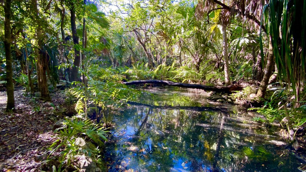
This huge underwater system provides the only freshwater available in Quintana Roo. It is well-known that both we humans and the flora and fauna of this area must share this underground river (and other water resources) to live—to drink, to survive the heat, and to meet human needs.
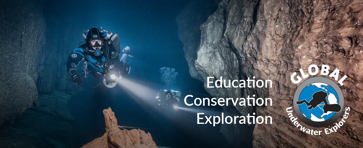
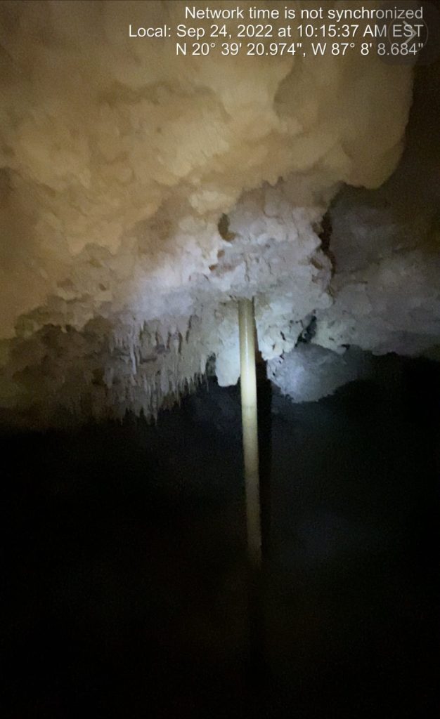
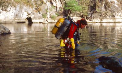
It also must be mentioned that the biggest cave in the world is also located in Quintana Roo, South of Tulum: Ox Bel Ha has more than 435 km/270 mi of galleries and passages filled with water and with unique formations (e.g., stalactites, stalagmites, and columns, among others) and a variety of protected and endemic species like the white lady and the blind swamp eel.
Furthermore, this underwater cave system is hiding the skeletons of giant sloths, bears, saber-toothed tigers, and mastodons, all of which have been found in the total darkness of Xibalbá—the so-called Mayan underworld. Even skeletons of the first settlers of America, along with Ice Age mining activities, have been discovered and documented in these underwater caves.


2018–2023: A short summary
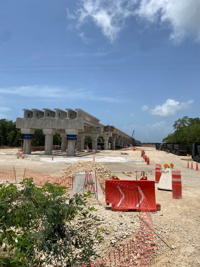
In 2018, the new President of Mexico, Andrés Manuel López Obrador, announced the Tren Maya, calling it the most important project to develop the Southern regions. It is a 1,500 km/932 mi circuit that seeks to connect the main cities and attractions of the area. Originally, project leaders said that the train was going to parallel the main highway (307) and incorporate many wildlife crossings. More than 20,000 trees were removed from the central ridge.
In 2019, there was a collapse on the highway; the highway itself crosses underground rivers and caves. In November 2020, seeing that the work was not moving at the desired pace, the President issued a “national security order” for this project, waiving the need for all permits and studies prior to work, which would speed up the project.
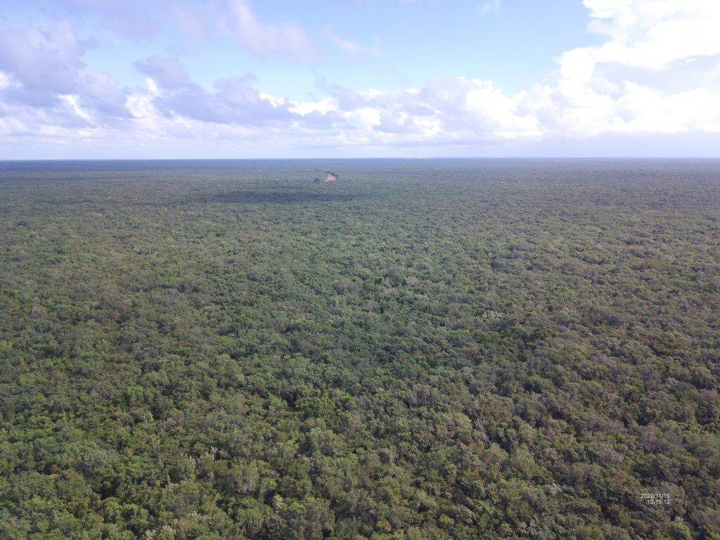
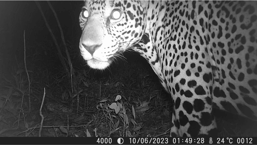
A few months later, under pressure from the hotel owners, the work on the road was canceled and leaders decided to move the train line to the jungle—without permits or any study of the land. It should be noted that Mexico is among the megadiverse countries: the club of Earth’s most biodiverse nations. The area chosen for train line construction is part of this virgin and well-preserved jungle, a habitat for the endangered jaguar and other threatened species. The health of the jungle directly impacts both the caves and underground rivers of this fragile ecosystem and the reef off the coast, which is part of the Mesoamerican Reef System (MAR), the second largest barrier reef in the world after Australia’s.
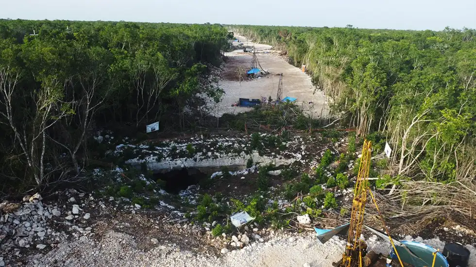
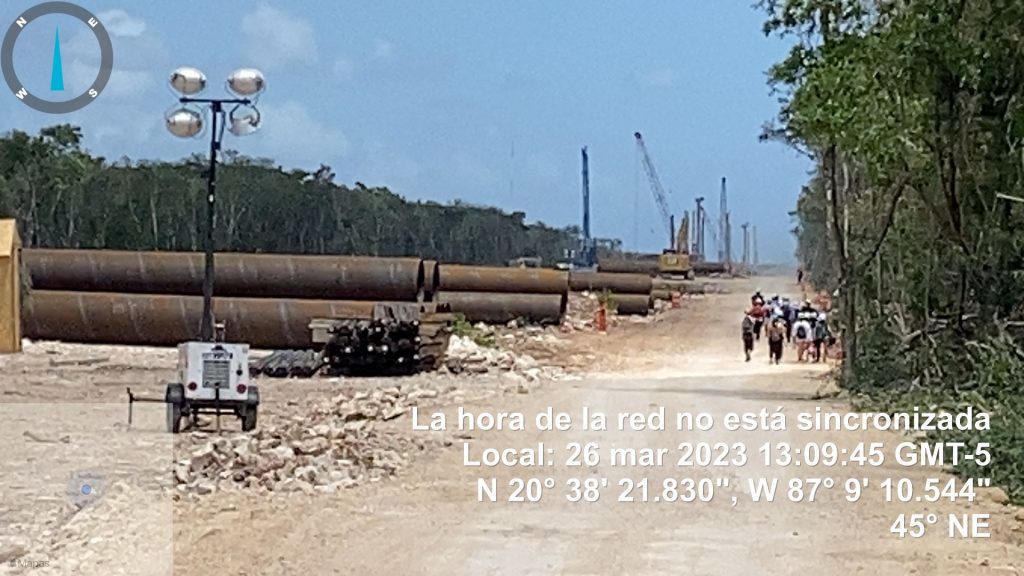
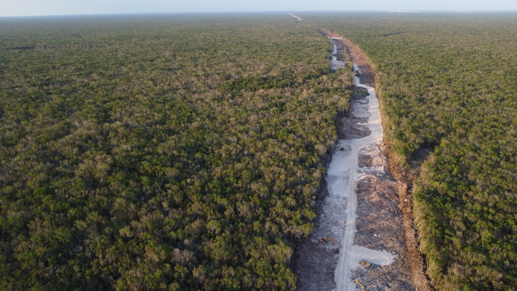
Without an environmental impact study, the deforestation of the jungle began, cutting down an estimated 10 million healthy trees and generating one of the greatest ecocides of Mexico. More than 120 known caves are directly affected by the project.
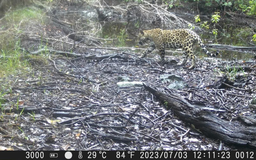
A suspension issued by a federal judge stopped work in the jungle for three months, but the government quickly continued, citing the National Security Act of 2021 as justification. The archaeologists had to work quickly to remove—without a formal study—a large number of vestiges from the path of the train. Five jaguars, likely displaced by the construction, have been killed by vehicular traffic on Highway 307 in the last seven months. These jaguars—protected, like margays and ocelots, by the NOM-059 as in danger of extinction—live in the jungle in the area affected by the destruction of the Tren Maya, evidenced by camera and video footage.
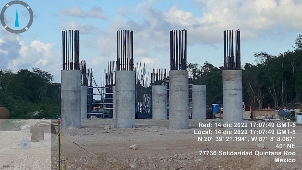
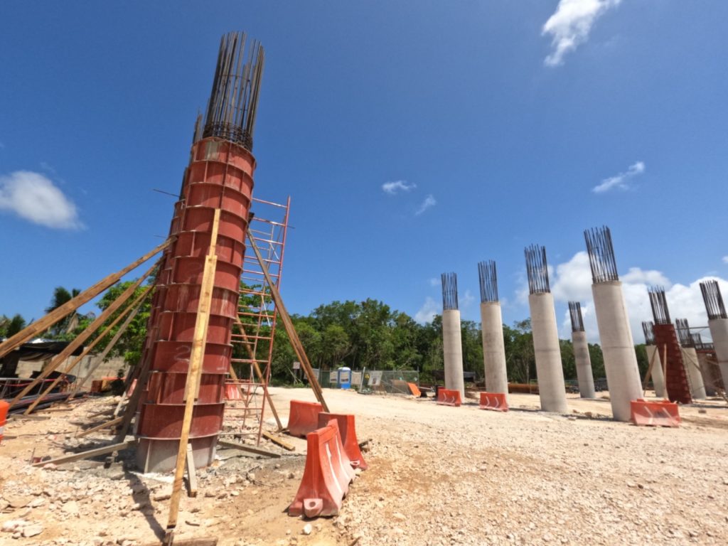
The project engineers, facing the complexity of the terrain and its large number of caves, decided to bury columns without the necessary permits or impact studies. Countless columns over a meter in diameter and 25 m/82 ft long riddle the aquifer and place the paleontological heritage and geological structures at risk. Since there are other caves below these columns, the project itself is at risk.
Apart from these aforementioned risks and effects, real estate pressures are also increasing driving further development at the expense of the untouched jungle. As the train demands more infrastructure and offers more access, we fear quickly losing these areas to further developments—authorized without necessary studies, just as the train was.
The Tren Maya is estimated to provoke a population rise on the peninsula to the tune of two million by 2030. As a result, water consumption could rise to four times that of the available resources by 2050. ”Hydro stress” is what hydrologists call water consumption in excess of the aquifer’s capacity to recharge/refill. This situation is a real scenario for the peninsula despite supposed ample water resources.
What are the consequences of the overexploitation of the aquifer mantle and the works of the Tren Maya?
Without the Yucatán Peninsula aquifer, we (humans and the ecosystem) will die.
To understand how this ecosystem works, it is important to understand that the fresh water aquifer is “floating” on a large layer of salt water that comes from the sea. Studies confirm that the salt water flows from the Caribbean Sea to the Gulf of Mexico due to a difference in height.
This fresh water aquifer has a lenticular shape—near the coast, just a few meters deep— while at the center of the peninsula, approximately 60 m/197 ft deep. When a well is overexploited, the fresh water is depleted, and the salt water below takes its place. Once a well is “salted,” it is very difficult for it to become “sweet” (fresh) again unless exploitation stops for a period of time. The problem for urban centers with salty wells (which already exist), is that (while feasible) this water must be processed by desalination systems (reverse osmosis) with the energy and technological cost that this entails.
Data from the Comisión Nacional del Agua (CNA) already reveals that 49.8% of the fresh water wells (the ones we use in our daily lives) in the Yucatán Peninsula show contamination for organic material (DBO). Furthermore, the same data shows that 20% of the urban areas of Cancun and Playa del Carmen have no drainage for black water waste; in all likelihood, including data for the town of Tulum will increase this metric to 50%. This information should alarm all of us since the contamination of the fresh water layer will deeply affect our survival: this fresh water is the only water available. The flora and fauna depend on our decisions. Unfortunately, until now, these decisions have focused on the destruction of the freshwater resources.
Who will suffer mainly from the increase in salt in the water from wells, cenotes, and aquifers?
When animals and plants do not have fresh water at their disposal, defaunation and, eventually, deforestation will affect the original jungle areas.
Who will take responsibility for the possible consequences of traversing the aquifer with many thousands of pilings of concrete and steel? How will the water quality and flows in the system be impacted?
Until today, no authority has dared to answer our questions.
What are the contingency plans for the runoff of grease and oil from a train on highly permeable karstic soil?
As far as we know, there are no plans.
What are the contingency and mitigation plans for a possible oil spill in the jungle in the event of an accident?
The federal government has already declared that the main cargo client of the Tren Maya will be Petróleos Mexicanos, transporting up to 80% of their total volume on the new railway. Only this data alone can make us consider what disasters could happen in the case of an oil spill.
What can be done?
Locally, our group, Cenotes Urbanos, is working to preserve the cenotes and the jungle. You as a diver or a tourist can help us share the information in this article as much as possible on international channels so that the cenotes, the water, the jungle, and the animals of this ecosystem are not forgotten and can be saved!
DIVE DEEPER
Help Preserve the Cenotes: Cenotes Urbanos
International Tribunal for the Rights of Nature: Tribunal Internacional
InDEPTH: SAVE THE CENOTES!
InDEPTH: Laying Line in Ox Bel Ha By Emőke Wagner, László Cseh and Bjarne Knudsen
InDEPTH: Data for Divers: Mexican Explorers Go Digital to Chart Riviera Maya by Michael Menduno
Alessandra Figari is a PADI course director, cave and rebreather diving instructor, and owns Enjoy Diving/Cave Training Mexico in Playa del Carmen. She was nominated as Associate Member of the EXPLORER CLUB in New York in 2017.
Elias Siebenborn is an Independant Tour guide specialized on history and nature, nature photographer, explorer, diver and amateur speleologist.
Roberto Rojo is a biologist and speleologist with more than 20 years of experience in public science communication. He’s served as the Director of the Planetarium of Playa del Carmen for six years. He is also the coordinator of the citizen science project, Cenotes Urbanos.
Guillermo Christy is an engineering and water treatment consultant with more than 25 years of experience. He’s also a nature lover, kayaker, canoeist, photographer, amateur speleologist


Dial In Your DCS Risk with the Thalmann Algorithm

Deep Tunnel Workers Go Trimix

La Grande Dérive

California Dreamin’

British Invasion—Thailand Karst Edition 2024

Harnessing the Power of ‘Educated’ AI to Improve Diving Safety