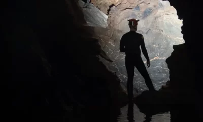
Cave
Data for Divers: Mexican Explorers Go Digital to Chart Riviera Maya
Mexico’s Yucatan Peninsula has long been the focus of underground exploration. Now a host of new tools such as digital surveying tools, mapping software, photogrammetry, drones, and augmented reality systems are making it easier for explorers to both collect data and share their findings with the world. InDepth sat down with veteran Yucatan explorer and geospatial scientist Sam Meacham to discuss his foundation’s extraordinary exploration efforts and get the lay of the land.
By Michael Menduno
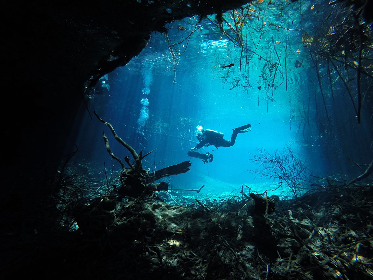
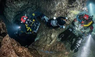
Photo by Sam Meacham CINDAQ AC
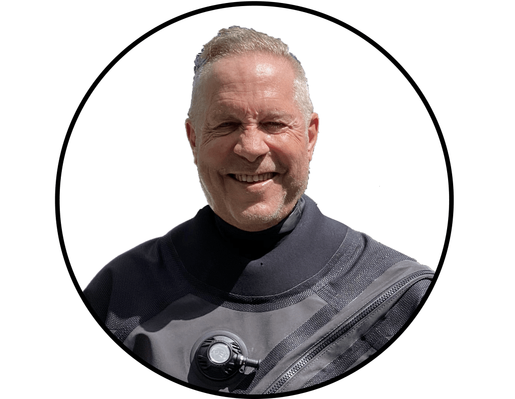
When I asked Sam Meacham how old he was during the course of our interview, he immediately quipped, “old enough to know better than to have dedicated my life to cave diving.” Fortunately, or unfortunately for Meacham, it would appear that his predilection won out.
The ardent 53-year old explorer, diving instructor, conservationist, geospatial scientist, mapmaker and founder of El Centro Investigador del Sistema Acuífero de Quintana Roo, aka CINDAQ—whose mission is to facilitate research, promote education, and support conservation of the cenotes and underground rivers of Quintana Roo, Mexico,has spent more than a quarter of a century peering off into the darkness and returning to tell the tale. In CINDAQ’s case, this typically takes the form of map data, logs, pictures, photogrammetry, geospatial data, video, film, and documentaries (BBC, CNN, National Geographic and PBS), lending support to famed explorer Bill Stone’s observation that “the difference between exploration and adventure is data!”
In that regard, Meacham and his pioneering colleagues, Fred Devos and Chris Le Maillot, owners of Zero Gravity dive center, and others, have been extraordinarily prolific, shedding light on many hundreds of kilometers/miles of underground passageway that form the circulatory system of Riviera Maya, to the benefit of policy makers, scientists, and citizens alike. “We are building on the pioneering efforts of those who came before us and trying to build up the generation that will follow,” Meacham explained.
In fact, over the last three years as a result of increased funding, new tools, and an enthusiastic pool of trained volunteers, they have actually stepped up their exploration and documentation efforts. Meacham, who was born in the U.S. and is also a naturalized citizen of Mexico and France, says they are just scratching the surface.
The New Frontier
One might say that the Yucatan, once considered the “new frontier” of cave diving back in the 1990s, occupies a special place in Sam Meacham’s diving firmament. In 1984, Meacham, then a lanky teenager, made his first dive during a PADI “Discover Scuba Diving” course while on family vacation in Akumal where he first met cave diving pioneer Mike Madden. He got PADI Open Water certification in Anguilla a year later. He was hooked.
Meacham returned to Puerto Aventuras nearly a decade later in 1994 to become a recreational diving instructor under Madden’s tutelage. That same year he completed his full cave certification with then National Association of Cave Diving (NACD) president Steve Gerrard. Meacham began work as an instructor at Madden’s CEDAM Dive Center, and later worked for Aquatech Villa DeRosa, where he learned from two additional cave diving mentors Gary and Kay Walten. It is also where Meacham first met Bil Phillips with whom he would share many adventures.
The 1990s was a period of intense cave exploration in the Yucatan, as competing teams of divers sought to connect two gargantuan cave systems, Nohoch Nah Chich and Dos Ojos, and by doing so claim naming rights for the combined system. Meacham was in the thick of it.
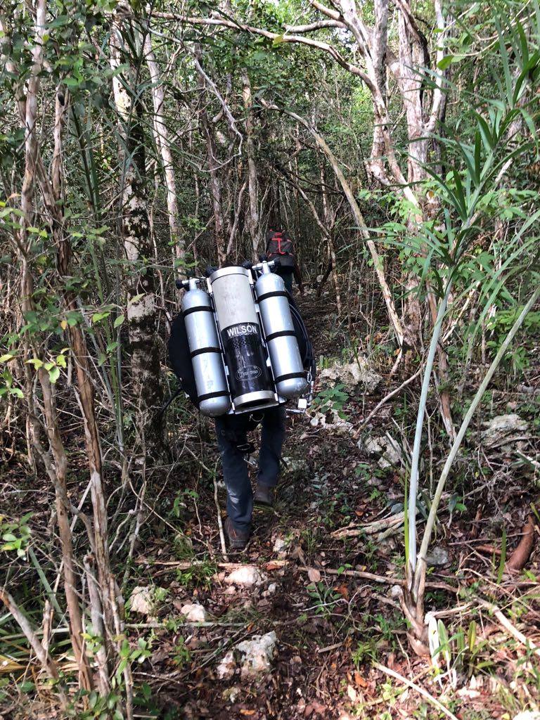
Deciding to branch out on their own, Meacham, Phillips, Fred Devos, Bernd Birnbach, Chris Le Maillot, Daniel Riordan and Sabine Schnittger began the early exploration of the Ox Bel Ha system, which CINDAQ has carried on to this day. “I am extremely proud of what we accomplished,” Meacham said. “We were too young to know it was almost impossible.” Most of the expedition work at that time was self-funded. The group ended up buying a horse (to ferry gear into the jungle) and a compressor.
Forming CINDAQ
In 2000, Meacham founded CINDAQ, a nonprofit foundation and recognized non-government organization (NGO), to provide a legitimate mechanism to solicit and accept funding to cover the cost of exploration projects. Their first sponsor was Aguakan, the company that supplied water to Cancun, and which wanted the team to explore and map the area around the company’s wells and help create a campaign to raise awareness of water issues.
Over the next eight years, CINDAQ was able to secure funding from numerous sponsors to continue their far-flung exploration of Ox Bel Ha, and later Sian Ka’an, including renting a helicopter to ferry divers gear to a jungle-locked cenote. He also participated in a number of documentaries including “Secrets of the Maya Underworld” and “Planet Earth: Caves” for various BBC units, “The Spirit of Nature,” for CNN, and forNational Geographic/PBS, “Strange Days on Planet Earth.” Many of these were filmed with Mike Madden with whom Meacham shares a passion of storytelling through film.
In 2009, Meacham was given the opportunity to go to graduate school and was accepted into a master’s degree program at the University of New Hampshire to earn a M.S. in Natural Resources with a specialization in geospatial science. His thesis: “Using Landsat 5 TM Data to identify and Map Areas of Mangroves in Tulum, Quintana Roo, Mexico,” used satellite data to locate and map mangrove in the Municipality of Tulum and down into the Sian Ka’an Biosphere Reserve. During this period, he put CINDAQ on hold. Upon graduation in 2012, he was offered a job as a research scientist and diving safety officer, at the Meadows Center for Water and the Environment at Texas State University.
CINDAQ Redux
In 2016, Meacham and his family moved back to their house in Mexico, and he began a reinvigorated effort to bring CINDAQ back to life. Meacham, who was now a Global Underwater Explorer (GUE) instructor and a member of the GUE board of directors, along with Devos and Le Maillot,were able to solicit private donations and, in cooperation with the volunteers at the Mexican Cave Exploration Project (MCEP), stepped up their exploration and mapping efforts. They focused on Ox Bel Ha and connecting caves further south into Sian Ka’an, which lies deep in the Mayan forest. Meacham calls Sian Ka’an the “Mount Everest of Cave Diving.”
“Sian Ka’an is pushing us geographically and logistically,” he explained. “It’s what Madden taught us early on. If you want to scoop booty, you’ve got to go where the booty is.” CINDAQ also supports the Hoyo Negro Project, started by fellow GUE instructor Alberto Nava, which graced the cover of National Geographic in 2015, and was the subject t of a NOVA/PBS special “First Face of America,” which aired in 2018; Meacham teamed up with Madden for this project and was an assistant to the camera man and managed logistics. “I’m thankful for the opportunities that cave diving has afforded me,” he said.
Key to CINDAQ’s current efforts is a host of new imaging, digital data collection, and presentation tools and technologies to aid in the exploration and create public awareness. InDepth caught up with Meacham earlier this year to discuss the team’s latest efforts.
InDepth: Has CINDAQ lived up to your expectations?
Sam Meacham: Absolutely, yes, and beyond. It exceeded my expectations. We established CINDAQ for pretty practical reasons and then it just kind of took off from there. And at the outset we had funds from Nature Conservancy, National Geographic Society, private funders and also the Summit Foundation in Washington D.C. We are extremely grateful for all of their support, and the support of our incredible volunteer divers through the Mexican Cave Diving Project (MCEP), which Chris Le Maillot and Fred Devos set up. Without both of these men we wouldn’t be able to accomplish even a fraction of what we do here.
It’s like living in a dream. Sometimes you shoot for the moon and you get the stars. So right now, we’re getting out into the stars and, in fact, several galaxies away.
I know that you’ve done an incredible amount of new exploration as well as going back and re-surveying the previous work of your team and others. Do you have any statistics that you can share with us?
Yeah, exploration is one of our main focuses right now because of the massive amounts of development that are taking place around Tulum, where the majority of the cave systems in this area are located. We are concerned about development and how it’s going to affect, not only the caves themselves, but most importantly the aquifer and the water that flows through our caves.
To give you a perspective, in 2018, out of a total of 18,000m/59,000 ft of total survey, 12,000m/39,300 ft was new exploration, and 6,000m/20,000 ft was resurvey of existing lines. By contrast, in 2019, we did a total of 80,000 m/262,000 feet of total survey; 30,000m/98,400 ft was new exploration and 50,000m/164,000 feet was re-survey. Then in January of this year, in just 14 days of diving, we resurveyed 8,445m/27,700 ft and explored 11,277m/37,000 ft of new passageway. So, it’s kind of been growing exponentially. And all of this is just in the Ox Bel Ha system.
So, what seemed like a preposterous proposal just a year and a half, two years ago: that we could resurvey an entire cave system the size of Ox Bel Ha, which is well over 300,000m/984,252 ft now, does not seem like such a crazy proposition anymore.
Amazing. I remember when I was coming up in the 90s, the Yucatan was regarded as the new frontier of cave diving, there was so much exploration going on. Now almost 30 years later, I am guessing much of the diving community, thinks, well it’s all been explored down there. And that’s obviously not the case. Any idea of how much remaining exploration there is to be done?
My response is a whole hearted, HAH! We’re still just scratching the surface. In fact, it doesn’t take much math, but you can figure out the ratio: for every one meter that we resurvey there’s just a bit less than one meter of line that gets explored. We’re going back into the caves and marking leads and getting into new areas and expanding the extent of the caves. That’s what we’re really most interested in because of all of the development happening at the surface. We really want to do a good job so we can show the general public and the landowners exactly what’s going on beneath them as accurately as we possibly can.
So just to clarify, we’re talking about new exploration in known cave systems, versus systems that have yet to be discovered.
Correct. Just as an example, we have been in the area of Ox Bel Ha we are diving right now for, I don’t know, the last two or three months. The last time we were in one of the entrances in this area was in 2009; I don’t think we’ve been in the other entrance since 2002 or 2003. No one has been in there. The reason we haven’t gone back is because it’s just really hard to get to. Development is a double-edged sword. On the one hand, it means more humans and more waste and pollution, but it also means new roads.
We now have a new road that runs through the middle of the jungle that takes us to three separate entrances and gives us access to a whole section of the cave that previously required a 45-minute hike to get to. So, yes, we are revisiting areas that we were in before, but we’ve never had the time and energy and ability to explore them to their full extent. Most of the original exploration that was going on there was all focused on the main tunnel, the gravy, the easy stuff. Now we’re focusing on linking up different sections of the cave to make it one.
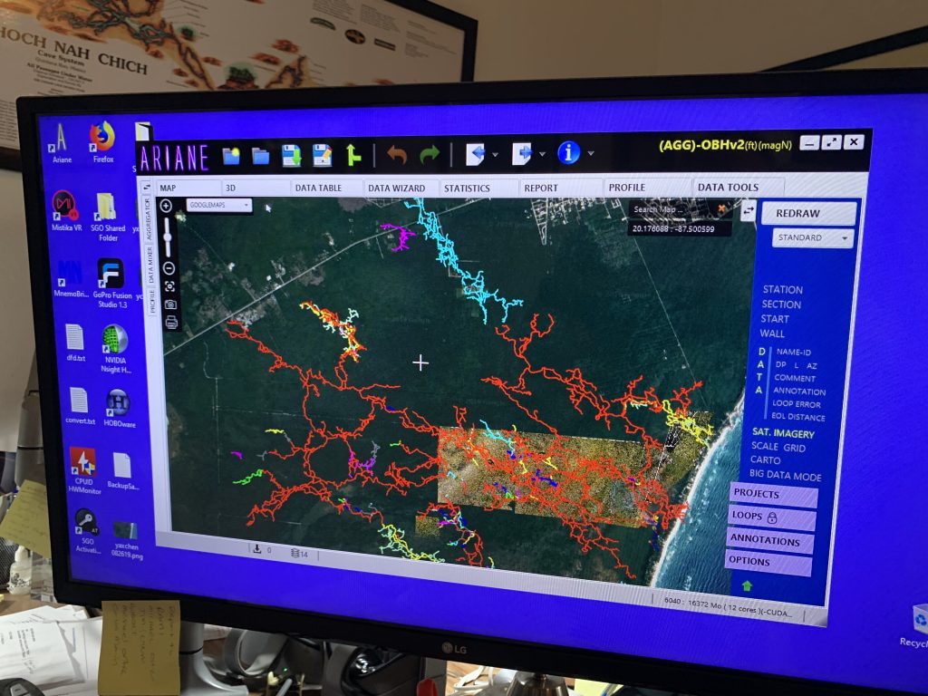
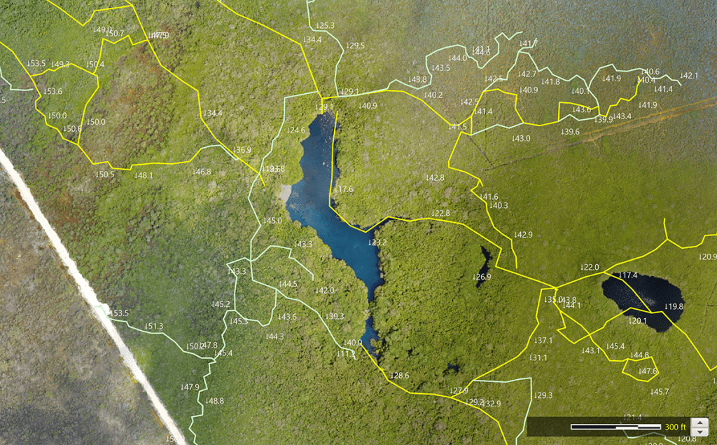
I heard that you started re-surveying old lines to test out some new surveying technology, the Mnemo and the Ariane cave mapping software, I want to talk about those. But why have you continued to re-survey?
That’s right. We started resurveying a small portion of the cave in 2018. The real objective was to see if the Mnemo and Ariane were good tools for us to use. We concluded pretty quickly that they were. The benefit is that by going in and re-surveying the caves, we’re not only shoring up the data that we already have, but we can compare the historical data to the new data we are getting.
It turns out that our historic data really wasn’t all that bad, but we benefit from better GPS now. It’s a lot more accurate, so we can correct things. In some cases, the original line survey had errors, which then threw the rest of the data off. Perhaps the coolest thing is that we are going back into areas of the cave that we haven’t been to for years as a result of better access, as I mentioned, and the fact that we have maintained good landowner relationships.
Tell me about Mnemo.
Well, for us, it started as a pet project in 2018. We’re very fortunate to have Sebastian Kister here who developed the Mnemo and also Ariane, the software that Mnemo communicates with, living right here in the Riviera Maya. At the time, I had heard about Mnemo and Ariane and I thought, okay, perhaps it will help us to get a handle on all the data that we have and help us be more efficient with time both in and out of the water.
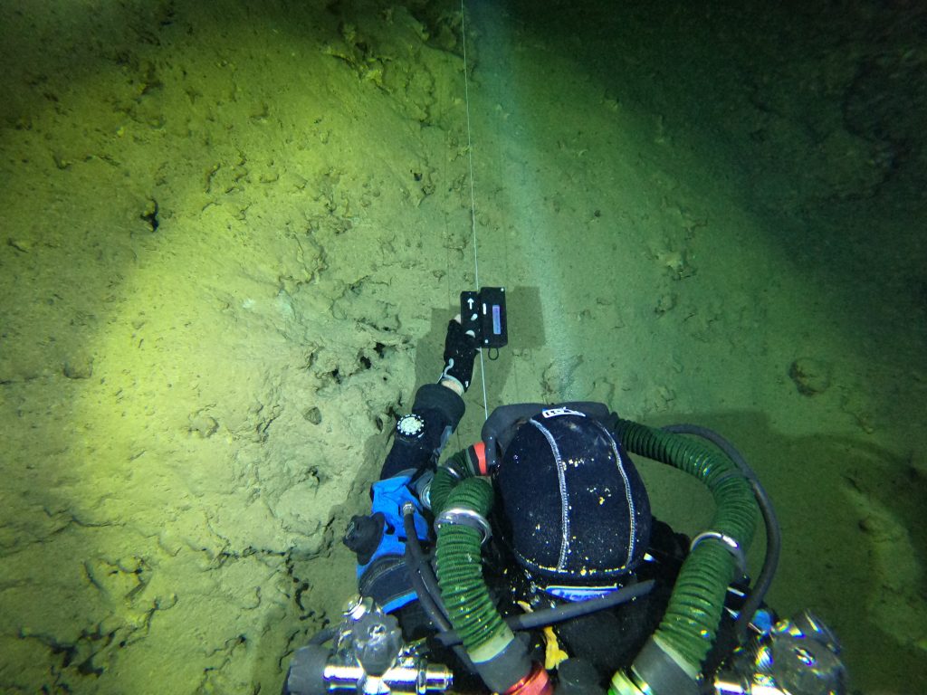
Mnemo is an ingenious and simple device that has an internal compass, an internal pressure sensor, so it can measure depth and azimuth, but perhaps the most ingenious part of all, is its ability to measure distance. That has always been a bit of a conundrum. The traditional means, of course, is knotting the line at fixed distances, but that leads to error, as it’s easy to lose count.
What Sebastian came up with is a wheel that looks a bit like a piece of pizza with slices on it, and it spins around. It has a white slice and then a slice with nothing in it at all, and there are two light sensors, which count the white slice every time, which is a known distance that goes by. You attach the Mnemo to the line, and swim the line, while the device records distance, depth, and azimuth. It takes a little practice, but it’s not hard to master. Last year I think we trained about 20 people to use it.
So you can swim or scooter and it just records as you go?
Yes. Scootering takes a little bit more practice, and you’ve got to be really careful because, of course, it has an internal compass, so you have to be very careful with anything magnetic, like a scooter’s battery and other electromagnetic components, in order to not interfere with the accuracy of the compass. You can survey on the scooter as long as you have big passageways. This allows us to cover a lot of distance in one dive.
Then you just connect it to the computer after the dive and it uploads the data to Ariane’s Line?
Yeah, it goes right in. You have to tell Ariane where the data starts, so, like any cave survey, you have to know where the tie-in data is. But as long as you know that, you can keep track of the lines that you resurveyed with the Mnemo, and within a matter of minutes you can easily enter a ton of survey data—boom—in no time at all. Normally, it would take quite a while to transcribe the handwritten cave survey data into Excel and then copy and paste it into another survey program, and then upload it. This process was also prone to errors. Mnemo is much more accurate than anything we were able to do previously. To give you an idea of its accuracy, we recently completed a massive 5,000+ meter loop. The loop closure error was less than 1%. We would have had a hard time doing that with a hand survey. The Mnemo just makes a lot of sense. And it has really streamlined our process in and out of the water.
Are you able to upload the old survey data into Ariane’s Line as well?
Yes. Sebastian made it so that we could import the original cave data into Ariane. It’s fantastic because it gives us a means of comparison. Like I said, our original survey was actually pretty damn good given that it was done 20 years ago often with 35 W halogen bulbs and a single person surveying out after a solo exploration dive.
I’m actually really proud of the survey that was originally generated. Interestingly though, some of the most valuable information in our survey work is the comments, for example like what you are seeing around you, the geology, the navigation symbols, directional markers, those sorts of things that help you to navigate the cave. So, by resurveying we are really enriching the survey comments which has a lot of benefits to safety and our general understanding of the cave.
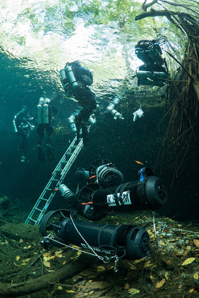
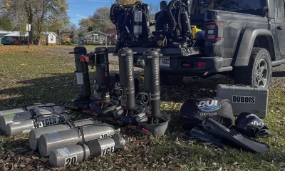
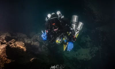
We are also benefiting from advances in technology. We’re going back into the passageways with better lights, better batteries, and better scooters. We’re using open circuit side mount, back mount and also RB-80s (semi-closed rebreather) in back mount and custom sidemount versions.
We have a great deal of versatility depending on what the cave throws at us. Especially with the RB80s, we can just spend up to seven hours of true working time underwater and get a lot done.
And I see you are employing lots of volunteers to help with the work!
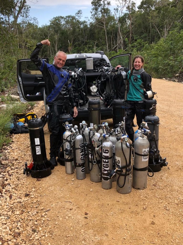
As with everything in Global Underwater Explorers (GUE), it’s a team effort and we’re extremely fortunate to have the team of people around us that support us and make it all possible. We have this fantastic wellspring of divers through our partners, the Mexican Cave Exploration Project (MCEP) who have amazing skills and are seeking purpose for using those skills. This is one place where we can totally put them to work. It’s a bit like Tom Sawyer convincing his friends to paint the fence. We’re doing the same thing with cave surveys. In fact, I have divers that just came back from a dive with data for me. They’re totally into it. They are just loving it.
The fact we are using Mnemo means that they can immediately see what they surveyed that day. Previously, with the manual survey, it would take hours to get all the data, and that was just a total pain in the ass. We’ve finally found the tools and we have this incredible army of volunteer divers who come here and help us achieve our goal. So that’s our main thrust at Ox Bel Ha, resurveying and exploring.
You have also been deploying drones and using drone software for finding new areas too, haven’t you? Talk to me a little about that.
Hah! We’re everywhere. We bought our first drone in 2017. And I’d like to call it the revenge on my parents who never bought me anything that was remote-controlled. Hence the drone. I guess you can’t take the boy in me away.
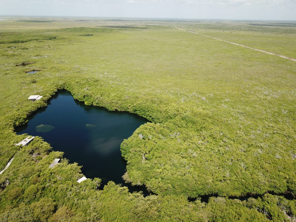
At the outset, we thought it was a pretty cool tool just to help us to have periscopic vision in the jungle. As you well know, the jungle here is extremely monochrome and flat. And even if you crawl just to the top of the tallest tree in the forest, you’re only a few inches above all the other trees. With a drone we can get above that and gain this incredible perspective of everything that’s down below.
It’s unbelievable that the technology, as it is right now, enables us to discover and document cenotes from a perspective that previously would have required a helicopter or an airplane, which would obviously be prohibitively expensive.
So last year, we applied for and received an enterprise license from a company called DroneDeploy based in San Francisco. It enables us to plan flights and create geo-referenced orthophotos of the surface. This allows us to have an accurate and up-to-date snapshot of what is happening on the ground and how it relates to what we are seeing in the cave. Ariane and ArcGIS allow us to overlay all of this data on the cave. I’ve been telling people it’s like Project Baseline, but in the sky. We can monitor a site and see what’s happening from year to year. DroneDeploy also has a rudimentary filter that allows us to see the health of vegetation which is immensely helpful in seeing where cenotes might be. Foliage around cenotes is going to be a lot healthier than the rest of the jungle simply because those plants have ready access to water. And it gives us a rough idea of elevation at the treetops which is another indication. Taller vegetation tends to be around cenotes.
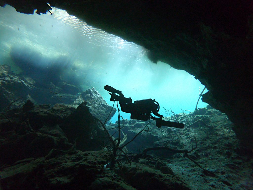
We can also use DroneDeploy to create a three-dimensional model of the terrain. We are doing a lot of photogrammetry of underwater passageways, so what we are going to conceivably be able to do in the future is to take a three-dimensional model of the surface and merge it with a three-dimensional model of the cave and have a real virtual experience where you can literally fly over the jungle and then down into a cenote and into the cave that is below it.
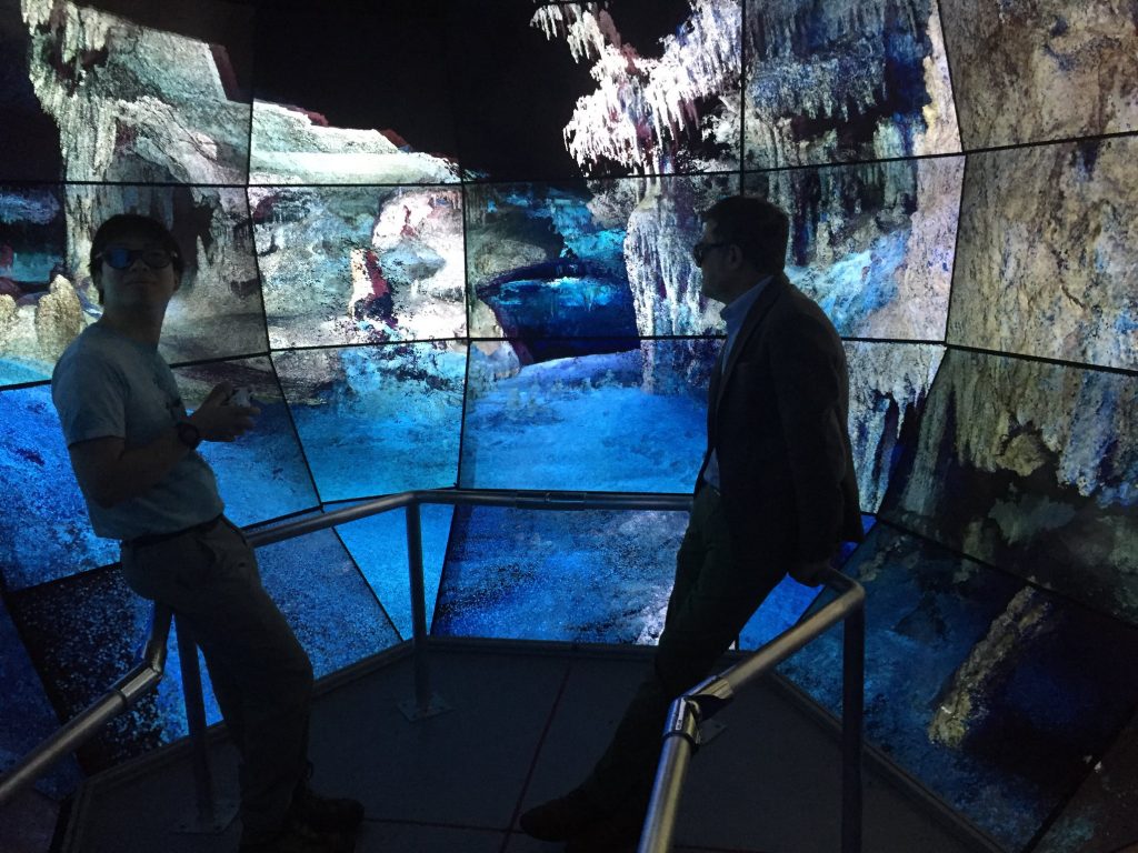
Augmented reality (AR) is something you all got to play with last year using the 360° Boxfish camera, right? The Oculus Go demo that you gave me was just awesome.
Yes, we had the opportunity to demo a Boxfish 360 camera last May, thanks to Russell Hughes of Boxfish Research. He put it into our hands and let us run wild. The results have been amazing. Augmented reality is different from virtual reality because we are just going along for the ride, and experiencing what the 360 cameras see. From an educational standpoint, this is a game changer for us.
Watch a 360° Camera Cavern Dive in Mexico’s Riviera Maya
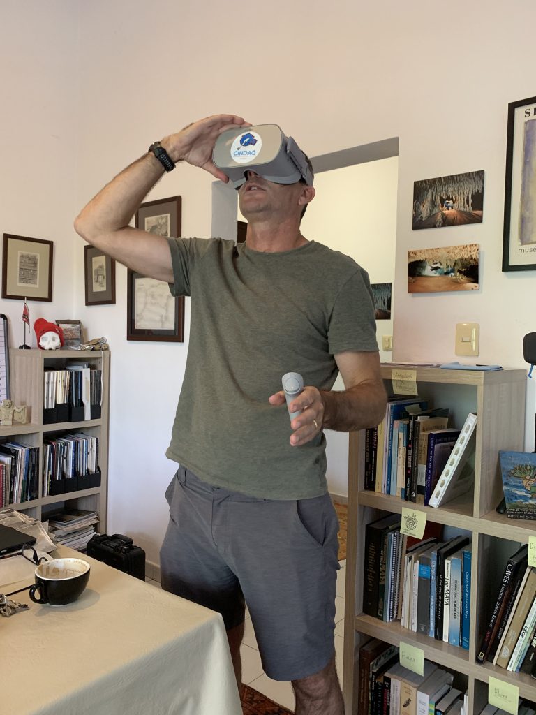
The interesting thing is that even experienced cave divers are seeing things that they’ve never seen before. We don’t usually stare up at the ceiling when we’re cave diving, so giving divers that perspective is pretty cool. One of the most rewarding things I have been able to do is to take my octogenarian parents, who have always been very supportive of me and what I do, cave diving with the augmented reality goggles.
And enable them to experience what a cave dive is actually like!
I can show people videos and photographs, write articles or do documentary films about what it is we do, and the environment we go into, but nothing has come anywhere as close as really connecting people to our world than the augmented reality stuff. My father was actually brought to tears. So, in just thinking about non-divers and raising awareness about this hidden world, we get pretty excited. Part of CINDAQ’s mission is educating people about the aquifer. And we’ve always had this incredible stumbling block helping people grasp what we experience when we go down there. We’re now convinced that we finally have a means by which we can educate people about the aquifer and the caves.
So for example, Mexican policy makers that are actually making policy that could affect the aquifer.
Correct, yes. For anybody that’s a non-cave diver, we can take them cave diving now without fear of them dying, which is good.
Always a good thing!
Yeah, and let’s not forget the scientists that we work with as well. We’re using a lot of photogrammetry to create models of the spaces that we go into. However, to enhance that with the augmented reality footage is absolutely fantastic. We’re just in this perfect storm of really cool technology that’s helping us to tell our story and, more importantly, to tell the story of these caves and the role they play, in a way that we never have before.
I’m not kidding when I tell people—and I say this almost on a daily basis—that I have never been more excited about what I do than I am right now. We are currently testing out all this cool stuff in Mexico, but there is no reason that it can’t be done in underwater caves all over the world to highlight the importance of groundwater. At the end of the day, that is the issue: our freshwater resources, since 20% of the human population depends on groundwater.
Have you seen any impact yet? Have you created awareness among the authorities there, the people you deal with, the locals, the policymakers?
Yes, local authorities are obviously aware of the fact that the cenotes are a huge economic driver for this area, and the diving industry is strong here. So, I think they understand the economic benefit of cenotes. Where people start to get a little confused is the incredible extent and magnitude of these massive cave systems like Ox Bel Ha and Sacactun.
But the idea, which started back in the early 2000s, is to show people the interconnectivity of everything. If you dump sewage in the jungle here, it’s going to come out in the ocean over here, and that’s not such a great thing if you want tourists to enjoy your beaches.
We’ve worked really hard to raise awareness about the importance of the aquifer here. We’re still lightyears from understanding how it all works, but yes, we’ve had an impact by helping to make freshwater resources an issue here. It’s challenging because there are no rivers and streams here; people can’t see the water beneath them. So it’s that much easier to contaminate and pollute because it’s out of sight and out of mind.
You have to enable people to see what’s going on!
Yes, that was the thing we realized early on; we had to find a way to bring the cave up to the surface so everybody could see it. We had to make people conscious of the fact that these things even exist, and that they exist on a massive scale that interconnect every single ecosystem that the tourist economy here depends upon.
If we don’t take care of the aquifer, which is the common thread to all of these ecosystems, then we’ve killed the goose that laid the golden egg. This area accounts for approximately 12% of Mexico’s gross domestic product and it’s all tourist based. So it’s hugely important to the regional and national economy that this place be as sustainable as possible. That’s where it’s hard to gain traction with decision makers: to convince people to have a long-term vision for the area versus a short-term vision.
Fortunately, we now have much better tools to engage the public and decision-makers and hopefully make people want to preserve and protect these incredible natural wonders that they can’t see. Nobody’s going to care about it unless they can feel something for it. That is our very difficult job; making people care about these incredible places underwater that are invisible to them.
That’s what gets you excited?
I lie awake at night thinking about the fact it’s not necessarily the things that we have found, it’s the things we haven’t found yet, the things waiting to be discovered that will be important to science. Whether it’s biological, paleontological, archaeological or hydrological, any kind of “-ology.” Those are the things that are so exciting. It’s the prospect of what we might find.
You can find Sam and CINDAQ Here:
Website: www.cindaq.org
Instagram: cindaq_mexico
Facebook: El Centro Investigador del Sistema Acuífero de Quintana Roo
YouTube: CINDAQ A.C.
Dive Deeper
Ariane’s Line: http://arianesline.azurewebsites.net
Mnemo: https://www.youtube.com/watch?v=uHNfQYkH2NI
Michael Menduno is InDepth’s editor-in-chief and an award-winning reporter and technologist who has written about diving and diving technology for 30 years. He coined the term “technical diving.” His magazine aquaCORPS: The Journal for Technical Diving (1990-1996), helped usher tech diving into mainstream sports diving. He also produced the first Tek, EUROTek, and ASIATek conferences, and organized Rebreather Forums 1.0 and 2.0. Michael received the OZTEKMedia Excellence Award in 2011, the EUROTek Lifetime Achievement Award in 2012, and the TEKDive USA Media Award in 2018. In addition to his responsibilities at InDepth, Menduno is a contributing editor for DAN Europe’s Alert Diver magazine and X-Ray Magazine, and writes for DeeperBlue.com


Dial In Your DCS Risk with the Thalmann Algorithm

Deep Tunnel Workers Go Trimix

La Grande Dérive

California Dreamin’

British Invasion—Thailand Karst Edition 2024

Harnessing the Power of ‘Educated’ AI to Improve Diving Safety