Cave
Grading Cave Restrictions
Cavers have been characterizing “restrictions,” a term believed to have been coined in 1975 by legendary explorer Sheck Exley, as “minor” and “major” for nearly 50 years. British cavers call them “squeezes.” But it wasn’t until John Burge published “Basic Underwater Cave Surveying” in 1987 that the terminology began to find its way into cave maps. Unfortunately, most current maps diverge from the use of minor and major restriction grading. That’s why cave cartographer Rory O’Keefe decided to propose a new system of measurement-based restriction grades to increase map accuracy, and answer divers’ questions. Squeeze on in!
by Rory O’Keefe. Images courtesy of the author unless noted.
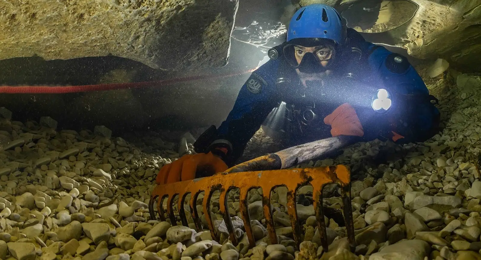
In cave diving, a restriction is defined as a point in the cave that is too narrow to allow a pair of divers to swim side-by-side. A major restriction adds the requirement for a diver to manipulate their body position and/or dive gear to pass the restriction.
In theory, it’s a simple concept. In reality, the system has its flaws; divers come in all shapes and sizes, they use different equipment configurations, and they have vastly different levels of experience. The result is that a minor restriction to one diver may be a major restriction to another. So, the question arises: why do we use this terminology?
Jim Coke of the Quintana Roo Speleological Survey says, “The term ‘restriction’ is a North Florida cave diving term that appeared during the early cave mapping years and is used instead of constriction, which is a more popular dry cave passage term.” When asked who might have been the diver behind the terminology change, Jim speculates, “Sheck [Exley] might have originated the term restriction, as he was by far the more prolific surveyor at the time.

Scanning through the early Underwater Speleology newsletters from the NSS-CDS, the first mention of the term restriction was in fact by Sheck Exley in 1975. In a review of the British Cave Diving Group’s newsletter, he writes that it’s “the most impressive periodical on cave diving that this writer has seen to date.” He praises the astounding quality of the group’s maps and safety record, “given the relatively poor diving conditions (water temperature, visibility, and restrictions) that they routinely encounter.”
Interestingly, when speaking to a longtime member of the British Cave Diving Group, I learned that they have never used the term restriction.” In Britain, restrictions are called a “squeeze,” indicating that Sheck may very well be the diver behind the word. (Note: Later editions of Underwater Speleology include reports dating back to 1969 that mention “restrictions,” but it’s unclear when these were actually written, as they weren’t published until the mid-1970s).

For the remainder of the 1970s, Exley was a pioneer in the development of safe cave diving protocols, culminating in his publication of the first cave diving manual, Basic Cave Diving: Blueprint For Survival, in 1979. While it can’t be definitively stated that he coined the textbook definitions of minor and major restrictions, it is reasonable to suggest that these terms likely evolved alongside the growing emphasis on safety standards throughout the 1970s. If nothing else, one thing is clear: cave divers have been grading restrictions as minor or major for approximately 50 years. But how often were these labels actually appearing on maps?
Prior to the late 1980s, restrictions were rarely labeled on underwater cave maps. In fact, the first map to feature restriction symbols in the NSS-CDS publication Underwater Speleology was a map of Cenote Dos Ojos by Jim Coke in July 1986. Although Jim doesn’t claim to be the inventor of these symbols, their use was definitely not widespread until the release of John Burge’s Basic Underwater Cave Surveying in 1987. In this book, John introduced minor and major restrictions as standard symbols, marking the beginning of their common usage in underwater cave cartography.

For the decades prior, cartographers relied on written reports to describe the passage details, including the size and location of restrictions. For many caving organizations, such as Britain’s CDG, this method is still the standard—and for good reason: cave divers across all organizations are trained to seek local knowledge about caves before diving, and these written reports serve as valuable guides, allowing for safe and accurate dive planning.
By the end of the 1980s, underwater cave cartography in North America had entered its golden age. Cartographers refined their techniques to produce geological maps that matched the detail of dry cave maps. They used symbology to show diver-relevant information such as restrictions, guideline depths, silt, ceiling heights, zero visibility locations, and penetration distances. Their maps now served a dual purpose: they documented the geology of the cave and provided divers with the necessary information to create a safe dive plan. The quality of maps from this era set a standard that is still sought after today.

During this time, it is important to remember that diving equipment was far from the quality of modern gear. As Jim Coke highlights, “Cave divers were more ‘bulky’ than those today.” He explains that while divers could swim single file through minor restrictions, major restrictions often “required the diver to remove their backmount tanks and push them through the restriction,” as British-style sidemount configurations were only in use by a handful of explorers.
To make matters worse, he says equipment failures were far more common, and that “their BCD’s were nowhere near to what is used today. There was no such thing as ‘wings’… So a simple restriction back then could become a real problem for a team member having equipment or gas issues.” Under this context, the logistics behind minor and major restrictions begins to make more sense – most divers were using the same configuration, and there was no need to account for various gear setups.
By the mid-2000s, everything changed. Rebreathers, DPVs, and sidemount configurations were no longer fringe techniques reserved for exploration; they had become mainstream. New cave divers could now start training on these systems right from the beginning. The result? Many divers might be surprised to learn that by the late 2010s, most cartographers had completely stopped using the standard definitions of minor and major restrictions.

Alessandro Reato, a cartographer based in Quintana Roo, Mexico, recently revised his approach to labeling restrictions after encountering frustrations with one of the major flaws of traditional restriction labels: divers are not all built alike and are not all trained to the same level of expertise. On his map of Sistema Minotauro, Alessandro initially labeled restrictions as minor or major. However, a few years later, he decided to remove these labels entirely. He explained, “After my Minotauro map, I am completely out of this problem. I didn’t label, in my recent maps, minor or major restrictions; I simply represent the walls where they are. In some places, using a ruler, any user can measure the distance between the walls and know if they fit or not.”
If we look at the underwater cave maps produced over the last decade, we can see that nearly all of them diverge from the traditional use of minor and major restriction grading.
For example:
- Fred Devos, map of Sagitario (2020): All restrictions are graded equal.
- Adam Hughes, maps of Charles Spring (2018) and Little River Springs (2020): Only sidemount and no-mount restrictions are labeled.
- Jason Richards, maps of Judges Cave (2017) and Hole In The Wall Cave (2017): Sidemount restrictions are graded by height. (<12” and 12”-24”).
- Alessandro Reato, maps of Kalag Dzonot Upstream (2021), and East Downstream (2023): Restrictions are removed.
- Steve Berman, map of Devil’s Eye Cave System (2000): Uses restrictions, major restrictions, and sidemount passage labels.
- Ryan Hoffmann, map of Maddachalk/Peacock Springs (2018): Only sidemount restrictions and extreme restrictions are labeled.
- Rory O’Keefe, map of Dos Palmas (2022): All restrictions are graded equal.
Cave diving has become far more accessible than its pioneers likely ever thought possible. High quality training is now globally available, and divers have an abundance of gear options to choose from. Numerous cave sites have become commercial operations with staircases, parking lots, bathrooms, restaurants, and diver platforms. Yet despite these drastic changes in accessibility, restriction terminology has stayed largely the same. Some agencies now define major restrictions as sidemount-only, but this doesn’t fully address the issue; a sidemount restriction for one diver can be a no-mount restriction for another.
My philosophy as a cartographer is that a complete map should include the answers to all of the diver’s questions. As restriction size is often one of those questions, it should be incorporated into the map. My solution to this problem is Measurement-Based Restriction Grades.

THE GRADING SYSTEM
The Survey Down Restriction Grades table uses incremental measurements to apply a grade to every restriction within an underwater cave system. The concept is to provide divers with a general idea of what to expect when planning a dive. It is not meant to indicate the precise dimensions of a restriction.
The system uses letters (A-F) to represent the width measurement, and numbers (1-6) to represent the height measurement. These grades will appear in place of the traditional “R,” or “X,” on a map. For example, using the table below, a grade of B6 indicates a restriction with a width of 90-120 cm/35-47 in, and a height of less than 40 cm/16 in.
The measurements will be based on the usable space within a restriction, rather than the longest possible dimensions of a restriction. Usable space is defined as the area within the restriction that is big enough to be of use to a diver. Additionally, the width and height dimensions are measured perpendicular to each other, however, these measurements are not required to be parallel to the floor or walls of the cave passage.

THE ASTERISK MODIFIER
Cartographers may use up to two custom asterisks to indicate recurring cave-specific conditions on a map. A few examples of these circumstances include reduced visibility, long restrictions, stability risks, or a possible need to dig.
If used, asterisks must be defined in the grading notes on the map. For example, if the asterisk modifier is customized to represent restriction lengths, the grading notes should define these increments as chosen by the cartographer:
- *Indicates a restriction of 3 meters to 6 meters in length.
- **Indicates a restriction of more than 6 meters in length.
The asterisk modifier is optional, and should only be used to represent features that have a significant impact on the usable space of a restriction.
BENEFITS FROM THE CARTOGRAPHERS PERSPECTIVE
- Greater cartographic consistency.
Cartographers strive for consistency in the style and quality of their maps, and measurement-based restriction grades are an additional means to improve this for both independent and group projects.
Divers will often notice a difference in what is labeled a minor, major, or no-mount restriction on cave maps made by different cartographers. This is due to factors such as the individual cartographer’s equipment configuration and experience. Additionally, cartographers are not always familiar with the varying equipment configurations used in modern cave diving, making traditional restriction grading challenging.
- Grading smaller passages that are technically not restrictions.
Cartographers rely on floor-to-ceiling heights, cross-sections, and profile views to highlight challenging areas such as low-ceiling bedding planes that do not fit the traditional definition of a restriction. Unfortunately, these areas are often missed by the casual cave diver as they can appear much bigger than reality on the plan-view of a map.
A measurement-based grading system can be used to call attention to these misleading passages. Because the grading system has the option to show passage dimensions “Over 120 cm / 48 inches,” cartographers can essentially apply a restriction grade to passages that don’t fit the standard definition of a restriction. Labeling these areas with a restriction grade will highlight that the usable space of a passage is smaller than it appears on the map.
- Remove the need for additional explanation.
A cave map that is designed to be used for navigation should include all of the necessary information that a diver needs to safely plan a dive.
With traditional restriction labels, it is common for divers to ask guides and other experienced cave divers about the size of a restriction. This indicates that cartographers should find a solution to provide that information on their maps. By using measurement-based restriction grades, cartographers will eliminate the need for supplemental information regarding the size of a restriction.

BENEFITS FROM THE DIVERS PERSPECTIVE
- Reliable dive planning.
Measurement-based restriction grades provide divers with the approximate dimensions of every restriction in a cave. There are numerous scenarios in which knowing the usable dimensions of a restriction will benefit a cave diver. Examples of this include:
- Teams can avoid awkward situations where they are forced to turn around in a small passage after reaching a tighter-than-expected restriction.
- Restrictions and tighter passages can be better described on stick maps.
- Restrictions that are used as a navigational reference, such as scenarios where a jump line is located on the other side of a restriction, can be better described.
- Divers who are trained in multiple equipment configurations can choose the best option for their planned dive.
- Teams will have the opportunity to decide whether it would be best to reach a section of the cave by an alternative route based on their chosen equipment configuration or training level.
- Stage and DPV usage can be better planned. Teams will also be better informed if these tools are inappropriate for a specific section of the cave.
- Reduces peer-pressure.
This system provides each team member the opportunity to form an independent decision regarding a restriction based on their personal training and/or comfort levels. This decision can be made in private, without the risk of peer-pressure, and without relying on the experience and/or memory of another diver to accurately describe the restriction.
- Survey notes.
Divers can quickly write down an estimated restriction grade while surveying for future reference. This is also useful for notes on potential leads through restrictions or quickly describing smaller passage sizes on a survey.
Measurement-based restriction grades will also provide additional insight into the cave when used on published stick-maps.
- There is no fundamental change to the definition of a restriction.
A measurement-based grading system makes no fundamental change to the definition of a restriction, only how they are labeled.
Divers that prefer the traditional labeling methods such as the classic “R”, or “X”, are reminded that a restriction grade means that there is a restriction or restrictive passage at that point in the cave. These divers can ignore any meaning represented by the grade and be content in knowing the traditional level of information: “There is a restriction here.” Meanwhile, divers who wish to use the grading system can refer to the table and learn the dimensions of the restriction.
As previously mentioned, any grade of A or 1 which represents a passage dimension of over 120 cm/48 inches, will only be used to highlight passages that are restrictive along one dimension.

CONS TO USING MEASUREMENT-BASED RESTRICTION GRADES
- Restriction size will become a competition.
Certain personality types will immediately seek the bragging rights of passing an F6 restriction – the tightest possible restriction on the scale.
It is unfortunate that this competitive mindset exists in cave diving, and as a cartographer, I am often evaluating the balance between withholding information from responsible divers in order to protect the irresponsible divers.
To prevent competitive restriction-chasing, I chose to stop the scale at “Less than 40 cm/16 inches,” even though it would arguably make sense to implement two additional grades beyond this point. An F6 restriction of 16” x 16” or less is small enough to indicate that partial gear removal will be required, but it is not so small to be considered a competitive challenge. Adding more grades beyond this point will absolutely become a competitive challenge.
- Restrictions are not perfect squares.
The reality of the situation is that the cartographer’s opinion on restriction size will not be entirely eliminated. There’s no way to account for every specific scenario, and cartographers will occasionally have to use their best judgment on how to grade restrictions that cannot be easily measured.
Fortunately, cartographers can at least use the approximate measurements in combination with their opinion to grade unusual restrictions, negating influence from other factors such as body size, equipment configuration, skill, and personal comfort.

- The A and 1 grades are too big to be restrictions.
Divers will notice that the first measurement range of “Over 120 cm/48 inches” is larger than what is typically considered to be a restriction. In fact, a grade of A1 is not a restriction. So, why does this possibility exist?
The restriction grading scale starts at “Over 120 cm/48 inches” so that cartographers have the ability to grade passages that are small across one dimension but long across the other. For example, a low bedding plane would fall outside of the standard definitions of a restriction, however, it should still be treated as a restricted passage, particularly by introductory-level cave divers using a sidemount configuration.
- It complicates a simple system.
Divers are reminded that the grading system makes no fundamental change to the definition of a restriction. When divers see a restriction grade, it means that there is a restriction or restrictive passage at that location in the cave. Those who do not wish to use the table may simply ignore the grading system and be content in their knowledge that there is a restriction at that point in the cave.

CONCLUSION
With the variety of equipment configurations being used by modern cave divers, labeling restrictions as major or minor is no longer practical. By grading restrictions based on their dimensions, these discrepancies can be eliminated with a simple change in how they are labeled on map.
To summarize the main reasons of why measurement-based restriction grades are useful:
- Creates consistent restriction grading across multiple maps from different cartographers.
- Adds needed explanation of restriction size on a map so that divers can plan appropriately.
- Allows divers to not rely on the personal opinion and/or memory of other divers when discussing the size of a restriction.
As Jim Coke says, “As long as the cartographer explains/defines a symbol in their Index of Symbols, you can use what symbols you choose to on a map.”
I will be implementing these measurement-based restriction grades on my upcoming maps, and I welcome other cartographers to do so as well.
DIVE DEEPER
Andy Davis Diving Blog: Grading Wreck Diving Restrictions by Andy Davis
InDEPTH: Meet Explorer Natalie Gibb by Evan Kornacki
InDEPTH: Zen and the Art of Mexican Cave Navigation by Natalie Gibb
InDEPTH: Data for Divers: Mexican Explorers Go Digital to Chart Riviera Maya by Michael Menduno
Survey Down: Rory O’Keefe | SURVEY DOWNYouTube
Off Gassing: Off Gassing: A Scuba Podcast Interview with Rory O’Keefe
Survey Down: RESTRICTION GRADES: A MEASUREMENT-BASED GRADING SYSTEM

Rory O’Keefe is an underwater cave cartographer and explorer based in Puerto Aventuras, Mexico. Originally from Canada, Rory discovered his passion for diving after completing his open-water certification in Tobermory, Ontario. He soon quit his job as a carpenter and moved to Mexico to pursue a new life in cave diving where he now resides with his wife – Natalie Gibb, owner of Under The Jungle Dive Shop. In September 2020, Rory started Survey Down, a website dedicated to teaching survey and cartography.
Links:
Website: www.surveydown.com
Instagram: https://www.instagram.com/survey.down/

