Community
Bringing Citizen Science To Lake Pupuke
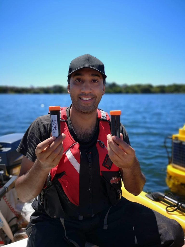
GUE diver and aquatic eco-toxicologist Ebrahim Hussain applies some serious citizen science to get to the bottom of the trouble in Lake Pupuke, New Zealand. Project Baseline is alive and kicking, thank you very much!
by Ebrahim Hussain
I have always been passionate about aquatic ecosystems and how they work which inspired me to become an aquatic ecotoxicologist. I have always tried to document observations in an attempt to better understand environmental changes. The biggest challenge I have faced was getting my observations to organizations that are able to use them in a constructive manner. We all constantly see changes in our environments but are often unable to make a positive change.
Citizen science is a greatly underutilized resource by regulatory agencies. There are a myriad of citizen science groups that actively want to participate in the monitoring of their local ecosystems, but they lack the guidance or platform to do so. The Project Baseline Initiative provides an amazing platform for people to display their findings, and in combination with guidance from local authorities, the resulting projects can be an overwhelming success. This article will hopefully take you through my journey to improve a local lake that means a lot to me and the people who use it.
Lake Pupuke is a 186 ft/57m deep volcanic crater lake with a surface area of 110 hectares that drains a 105 hectare urban catchment in Auckland, New Zealand’s North Shore. The influence of this urban catchment on lake water quality is enhanced by the fact that the lake has no direct in and/or out flows and consequently has a high water retention time. Water enters the lake via a variety of diffuse sources (runoff, groundwater & precipitation) and exits through evaporation and intermittent drainage channels.
The lake is used for a variety of recreational purposes and is a venue for national and international events. The lake is also widely used by dive schools and boat clubs from across the region as a training facility.
A Lake Under Threat
I have been diving in Lake Pupuke since 2013, and I quickly came to realize that this lake was under threat. The water clarity had decreased, and according to the local dive schools, this deterioration had been noticed for many years prior. In the summer of 2014 a thick algal bloom developed which had not been recorded previously. The initial concern was the potential human health risk associated with algal blooms, but samples taken by the Auckland Council identified the bloom as Ceratium hirundinella which is a nontoxic species.
It was quite puzzling that even though Ceratium has always been present in the lake it had never formed large scale blooms until 2014. It was thought that this bloom was a once-off event until it occurred the following year and every summer since.

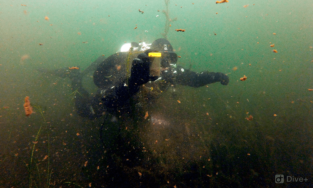
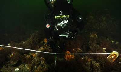
Ebrahim Hussain installing a dissolved oxygen & temperature sensor on the monitoring station. Photo by Andrew Davidson.
In an attempt to understand what had caused this change, I began looking at the Council’s long-term monitoring data, and to my surprise, I could not find anything that pointed to the exact cause of these recurring blooms.
I initially looked at temperature and nutrient loads which are the most common drivers for algal blooms and found that the lake had not been significantly warmer than previous years, and the trophic level index, while elevated, was within the same variance seen over the past ten years. However, there was no associated metadata to support any conclusions. It was clear to me that we could not fully understand what was happening in the lake through seasonal surface-based water quality sampling alone, and that regular subsurface observations were needed.
Enter Project Baseline
That is when I came across the Project Baseline Initiative, and it was the perfect platform for the type of work I wanted to conduct. The primary focus was to collaboratively work with volunteers, local communities, research organizations, and the Auckland Council to collect data that would complement the work already being done by the Council, as well as to specifically address the subsurface knowledge gaps. By doing this we are able to make use of both Council-funded and citizen science-driven data acquisition to support and inform a more holistic management strategy for Lake Pupuke.
We initially started collecting very basic data, such as visibility, temperature, and general meteorological information, but this quickly ramped up once we started noticing what was happening underwater.
We installed continuous temperature sensors, which log data every 15 minutes, at various depths to get a better understanding of the seasonal thermal stratification in the lake. Our data indicates that the lake usually stratifies from October until June, with an average winter temperature difference of 0.7°C between surface and bottom waters, and a summer difference of 10.2°C.
Stratification in lakes of this depth is a natural result of the surface water layers being heated by the sun. This heating causes the formation of a thermocline where the warmer water layer sits above the cooler, denser bottom water. This process separates the water column into three distinct layers, the epilimnion which is the warmest layer on the surface, the cooler metalimnion in the middle, and lastly the hypolimnion which is the coldest layer at the bottom of the lake. This separation of layers reduces the mixing of heat, oxygen and nutrients between the surface and bottom waters.
It is important to track these changes in stratification because it is directly related to the potential oxygen cycling and internal nutrient loading within the lake.
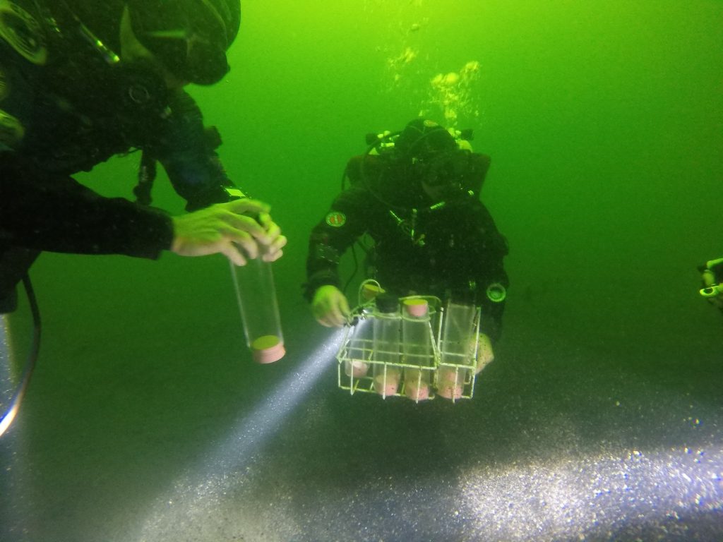
We installed continuous dissolved oxygen (DO) sensors within these distinct thermal layers to assess this oxygen cycling, and what we found was surprising. In winter the DO% on the surface ranges from 86% to 98% and gradually drops in even gradations down to about 40% at 55m. In summer the DO% ranges from 80 to 90% on the surface down to less than 3% at 55m. This is expected, but what took us by surprise was the presence of midwater anoxic layers, one near the surface between 7m-9m, and a second layer in the metalimnion between 12m-16m.
The Results
After seeing this, we began investigating other potential DO dead zones in the lake using multi-parameter water quality meters and have since identified additional areas. There was evidence of anoxia in the macrophyte beds that surround the lake, so we deployed additional sensors, and our finding confirmed our initial assumptions with summer DO% dropping to less than 3%.
This is critical information, as anoxic sediment conditions actively promote the remobilization of nutrients which further contribute to the eutrophication of the lake and drive algal bloom formation. These conditions can also cause the release of ammonium & hydrogen sulphide which are all toxic in high concentrations.
The next question we had was what was causing this anoxia. It is natural for a lake this deep to have anoxic bottom waters during summer, but we did not know what was causing this anoxia midwater and in the macrophyte beds. The dense macrophytes stop water from freely flowing into the shallows, and there is a lot of visible organic material that is decomposing on the bed, which all contributes to the anoxia.
The increased load of organic material, composed of dead macrophytes & phytoplankton, seemed to coincide with the appearance of the algal blooms. To prove this we installed light sensors that continuously measure the photosynthetically active radiation attenuation at various depths. The data shows that at on average there is almost no usable light past 4m after 13:00 and zero light penetration past 10m during the summer blooms. This lack of light caused the macrophytes to die, and coupled with the dead phytoplankton settling down, created an influx of decaying matter on the lake bed. We now regularly conduct macrophyte extent surveys to document seasonal die back and regrowth.
We knew where the additional organic material was coming from and what was causing the anoxia in both the macrophyte beds and the hypolimnion. The next question was how many nutrients are being released from these areas and what is causing the midwater anoxia. To answer this, we started a collaborative project with the Auckland Council and the Cawthron Institute.
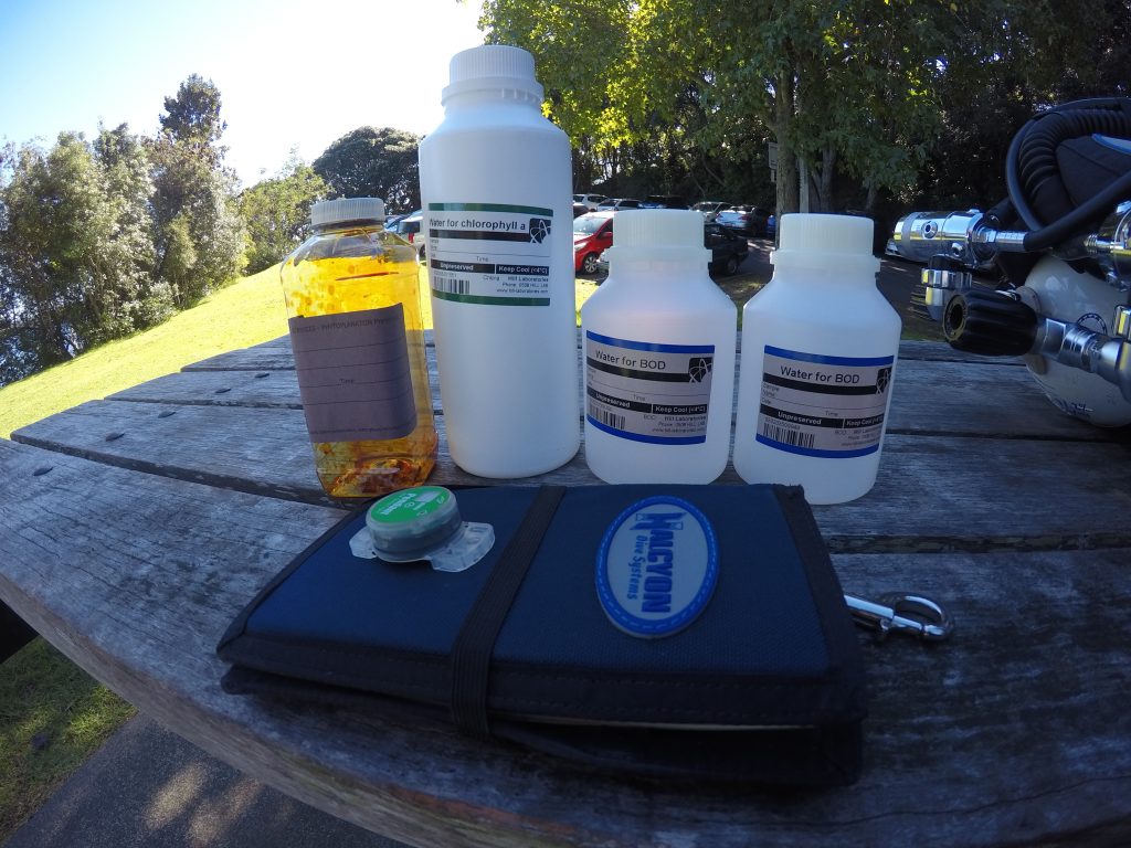
The first step was to install sediment traps at various depths to understand how much organic material is produced midwater and how much settles down to the bed. The second step was to take a suite of sediment cores from the areas of concern we had previously identified to understand the amount of nutrient remobilization that occurs under various environmental conditions. The third and final step was to take targeted water quality and phytoplankton samples from the midwater anoxic layers to understand how/why they are formed.

The majority of the sampling required has been done except one more round of winter sediment traps. Once this has been completed, all the data will be analyzed and will fill a critical knowledge gap regarding internal nutrient cycling. This in turn will help guide the next steps for the wider project as well as inform potential mitigation measures.
Project Baseline has provided an amazing tool to facilitate the collaboration between citizen science and local government by formalizing community-driven data collection. The Project Baseline Lake Pupuke Initiative is a proven example of how citizen science can be used to satisfy critical knowledge gaps and directly feed into regulatory strategies with the common goal of creating a better, healthier environment.
Ebrahim Hussain is an Aquatic Scientist working at the Auckland Council. He began diving when he was 12 years old and has never looked back. Hussain studied aquatic ecotoxicology and zoology at university, and it was clear that he wanted to spend his life studying these subsurface ecosystems and the anthropogenic stressors that impact them. Hussain founded Project Baseline Lake Pupuke with the goal of contributing to preserving and enhancing this natural beauty as well as encouraging others to get involved in actively monitoring their natural surroundings.


Dial In Your DCS Risk with the Thalmann Algorithm

Deep Tunnel Workers Go Trimix

La Grande Dérive

California Dreamin’

British Invasion—Thailand Karst Edition 2024

Harnessing the Power of ‘Educated’ AI to Improve Diving Safety