Conservation
Citizen Science to The Rescue: Getting to the Bottom of Lake Tomarata
Lake Tomarata and the surrounding wetlands near Auckland, New Zealand were mistakenly believed to be low-value habitat with limited–to–no biodiversity. That’s until water quality scientist Ebi Hussain and his posse of citizen scientists took up the case and started collaborating with local partners. Here’s what a team of dedicated volunteers can do.
by Ebrahim (Ebi) Hussain
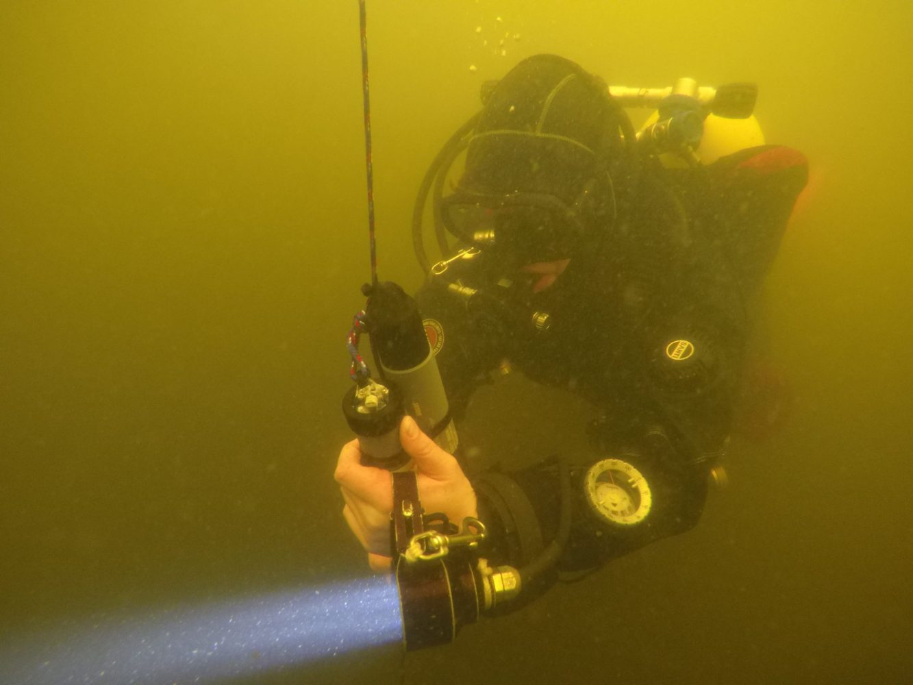
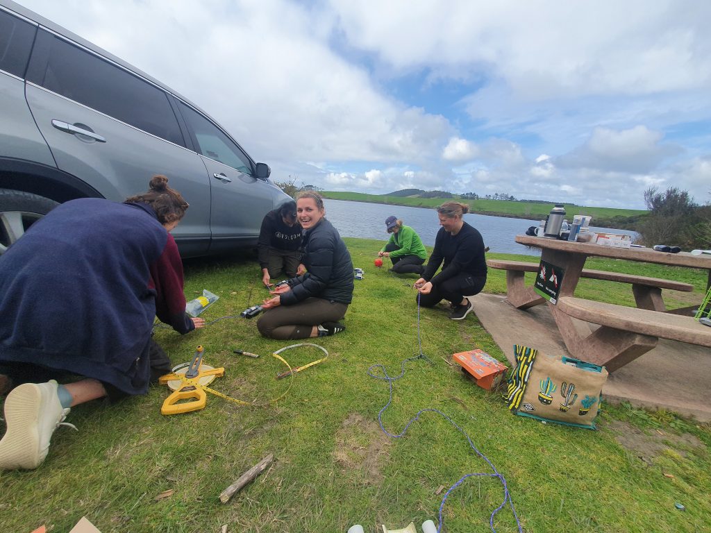
Header image: Louise Greenshields installing continuous pH and dissolved oxygen sensors. Photo by Ebi Hussain
Lake Tomarata in New Zealand’s Auckland region, is surrounded by an extensive wetland—the only one of its kind in this region. Its ecological significance and rich native biodiversity, including several threatened and endangered species, make the lake and wetland complex unique and deserving of protection. It is dangerously significant that only ten percent of New Zealand’s wetlands still exist.
A very small subset of these wetlands are considered as lacustrine wetlands, making this ecosystem critically endangered; only one percent of this wetland’s original extent remains. The lake itself is equally unique and is the only example of a peat lake system in the Auckland region. The fact that these two very rare ecosystems exist together in one place makes this site extremely special and has set the stage for our most comprehensive project to date.
Both the lake and wetland have been independently studied before, but there has been no ecosystem scale assessment that examines both systems as one interconnected environment. The wetland values are well-described in published literature. However, the ongoing pressures and impacts from the surrounding catchment are not fully understood. The lake has been monitored over time, and the general consensus is that there is limited to no biodiversity values present and the water quality is deteriorating .
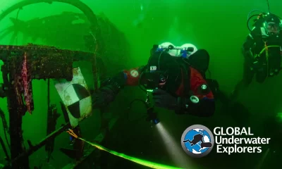
Our visits to the wetland and dives in the lake alluded to something more than the degraded systems described. Instead, we uncovered a misunderstood environment with complexities that led to the false assumption that the lake had low ecological value. This highlights the value of citizen science and in particular, divers that are able to regularly document areas that most people don’t frequent.
We wanted to legitimize our findings and debunk the false portrayal of this unique environment. To do this, we wanted to create an open access integrated ecosystem management tool that could be used for collaborative monitoring and restoration. This tool would need to be based on accurate ecosystem scale assessments and integrated into a single geospatial platform where all data could be viewed and interpreted. To create this tool, we needed to map the entire environment as one ecosystem, establish an in-lake biodiversity baseline and current state assessment for both systems, integrate all the data, and develop monitoring techniques that would inform management plans.
This seemed completely unachievable for a group of volunteers, but we did not let the monumental task intimidate us. We drew up a plan, put together a team, and pushed on one step at a time.
Draw Me A Map
The first step in understanding an ecosystem is to map the environment and create a spatial platform to guide in-situ surveys and integrate multidisciplinary data. This project was the first time we mapped aquatic, terrestrial, and transitional environments to create a single ecosystem model.
The challenge with this type of mapping was that we needed to work in three dimensions because the surface and subsurface environments are interlinked. The best way to do this was to use various survey techniques and data inputs for each environment to create an integrated, three-dimensional model of the entire ecosystem.
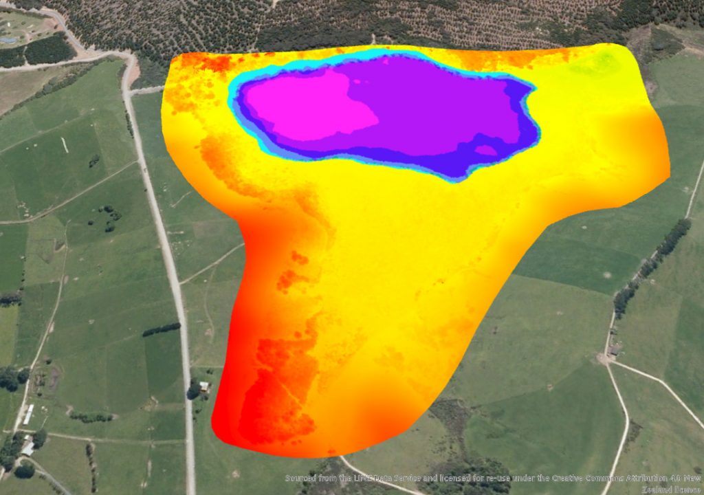
To map the lake, we used existing hydroacoustic data collected using a variety of methods including sonar, depth sounders, and pressure transducers to create a bathymetric map of the lakebed. We used divers to ground-truth (i.e., check the accuracy of) the bathymetry, and map the shallow transitional areas between the lake edge and the wetland. The result was a high-resolution map of the lakebed and general lakebed characteristics.
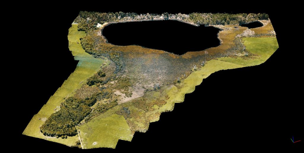
We mapped the wetland using drone imagery and existing data inputs. We flew a drone along a pre-programmed geo-referenced grid that spanned the entire sub-catchment to obtain high resolution imagery. This imagery, coupled with LiDAR data, was used to create a three-dimensional point cloud, ortho mosaic, and digital elevation model of the entire sub-catchment.
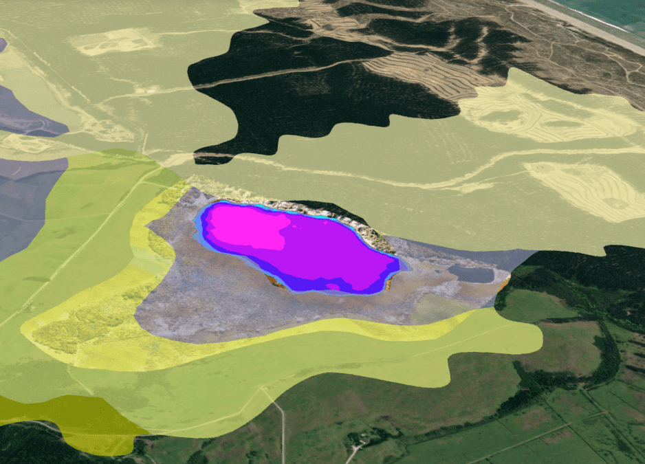
We combined the surface and subsurface mapping to create a single three-dimensional model of the entire ecosystem. This gave us the ability to visualize both systems as an integrated environment and extract detailed spatial and environmental information. This model would also be used to display and integrate all the survey data. To frame this data into the context of the wider landscape, we overlaid the catchment land use split, overland flow paths, soil types, and ecosystem classification. This allowed for a greater diagnostic power when assessing the potential impacts of changes in the wider catchment.
Assessing Lake Biodiversity
The biggest knowledge gap we faced was in-lake biodiversity. There have been several reports discussing the general health of the lake and discrete ecological surveys, but no conclusive lake-wide assessments. One of the conclusions drawn by a majority of the published literature was that the lake is completely devoid of plants and is overrun by pest fish species.
We used the bathymetry to design a lake-wide survey aimed at assessing habitat quality, macrophytes, key stone species, and benthic flora and fauna. The first survey was to map out specific habitat types throughout the lake; these areas were then plotted on the three-dimensional model. We used the habitat assessments to guide the other biodiversity surveys, since they gave us an idea of where various species may occur.
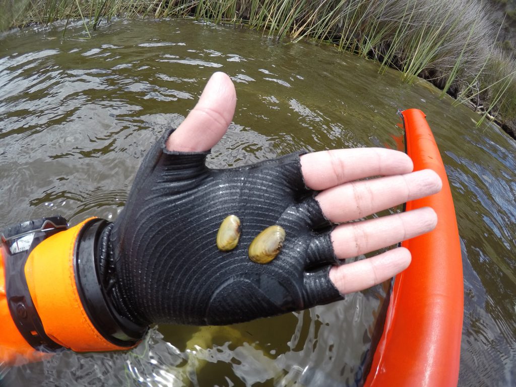
During the biodiversity surveys, we made some ground-breaking discoveries. Despite the lake being classified as non-vegetated, we have mapped nearly 1 km/0.62 miles of native macrophyte beds along the southern and western ends of the lake. We also found freshwater mussel beds on the eastern side of the lake, which was an amazing discovery, as no one knew these endangered species existed here. Recently, we were lucky enough to find the first juvenile freshwater mussels ever recorded in an Auckland lake.
So far, our findings indicate that this lake is far from a barren waterbody. There are signs of natural regeneration and established populations of endangered species. It is critical that we get this message out and raise the profile of this lake: the more we know about a place, the more we value its protection.
Establishing a Baseline
A baseline state is essential to track changes over time. We wanted to take an integrated ecosystem approach to the baseline assessment rather than focusing on tracking single metrics and using them as a proxy for wider environmental health.
The first step was to use the three-dimensional model we created to define the current extent of both the wetland and lake environments. Tracking changes in extent over time provides information on wetland succession/recession, water level, lake infilling, and habitat change. We used the high-resolution drone imagery to delineate discrete vegetation types across the wetland, and we aim to calculate vegetation biomass in the future. This will allow us to track changes in vegetation assemblages in response to eutrophication, sedimentation, and climate change.
The in-lake biodiversity assessments were used to create a baseline for in-lake health. Ecological response metrics like macrophyte extent, mussel density, substrate/habitat change, and species diversity will be used as a biological sentinel network that integrates the effects of multiple impacts across the ecosystem.
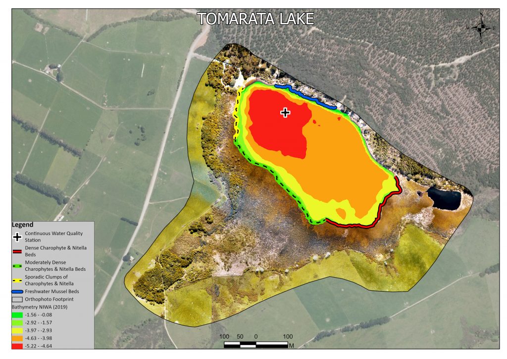
Changes in water quality are pivotal to both the lake and wetland, so it is crucial that we fully understand the current state. To understand the diurnal and seasonal variation in water quality, we installed continuous water quality sensors (temperature, pH, dissolved oxygen, and light) at every meter through the water column; these sensors will log measurements every 15 minutes for a year. This data, coupled with the monthly water quality samples and climate data from the Auckland Council, will be used to create an in-lake process-based model that can be used to understand and predict lake dynamics.
We will also integrate additional data such as bird counts, pest fish surveys, and hydrological studies collected from other agencies into our assessment. This information, along with other geospatial data, can continually be added to the platform as they become available.
Tracking all these parameters creates an early warning system able to detect subtle changes in ecosystem health. This integrated response-based approach is more sensitive than traditional monitoring methods. The in-lake, process-based modelling will continue to be calibrated as we collect more data, which will eventually allow for accurate scenario testing. The end goal is to be able to detect changes early enough that we can test virtual restoration/management scenarios and implement the most effective solution before significant degradation occurs.
Management & monitoring
The key to successful ecosystem scale management is collaboration. We created an open access platform for everyone with a vested interest in this area, not only so they could use the model, but so they could also contribute their own data. We established the baseline ecosystem state—which can be referenced in all future studies—as well as the monitoring tools required to track environmental changes. The last step will be to introduce people to our work and set up collaborative working groups focused on Lake Tomarata.
Currently, we are partnered with the Auckland Council, which has regulatory authority over the area. The Council and Aotearoa Lakes have a joint monitoring and data-sharing agreement which allows both parties to benefit from pooled resources, expertise, and data. We are working with the local communities and tribes from the area to raise the profile of this ecosystem and create an interest that will hopefully lead to proactive lobbying and restoration efforts.
Our integrated ecosystem monitoring design, spatial representation of multidisciplinary data, and ability to scenario-test management options creates a publicly accessible platform for informed collaborative ecosystem monitoring and management.
What makes this effort so special is that it was all done by dedicated volunteers. This project proves that citizen science can stand up to the rigor of commercial standards and in some cases even surpass it. I hope this article will inspire you to take action despite how Herculean the task may appear to be. There is nothing more powerful than a collective of like-minded people applying themselves to a single cause.
Dive Deeper:
Please visit our website Aotearoa Lakes: Citizen Science for Our Lakes for more information on our projects. Note that “Aotearoa” is the Maori (the indigenous people of NZ) name for New Zealand, literally meaning, “land of the long white cloud.”
Check out their 3D model of Lake Tomarata: Aotearoa Lakes Eco-Maps. To get to the Lake Tomarata model, click on the website maps link (above). A banner pops up along the bottom of the screen with pictures of various lakes side by side. Click on the “Tomarata Lake” site which is the 3rd box from the left on the bottom banner.
Facebook page: Aotearoa Lakes: Citizen Science For Our Lakes
Home of Project Baseline
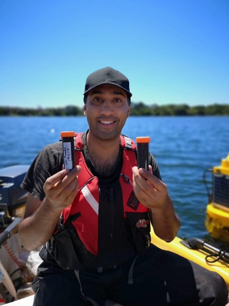
Ebrahim (Ebi) Hussain is a water quality scientist who grew up in South Africa. As far back as he can remember, he has always wanted to scuba dive and explore the underwater world. He began diving when he was 12 years old and he has never looked back. Diving opened up a new world for him and he quickly developed a passion for aquatic ecosystems and how they work. The complexity of all the abiotic and biotic interactions fascinates him and has inspired Ebi to pursue a career in this field.
He studied aquatic ecotoxicology and zoology at university, and it was clear that Ebi wanted to spend his life studying these subsurface ecosystems and the anthropogenic stressors that impact them. After traveling to New Zealand, Ebi decided to move to this amazing country. The natural beauty drew him in, and even though there were signs of environmental degradation, there was still hope. Ebi founded Aotearoa Lakes with the goal of contributing to, preserving, and enhancing this natural beauty as well as encouraging others to get involved in actively monitoring their natural surroundings.

