Latest Features
Cave Bugs, Cartography & Collections, Confessions of a Phreatic Volunteer
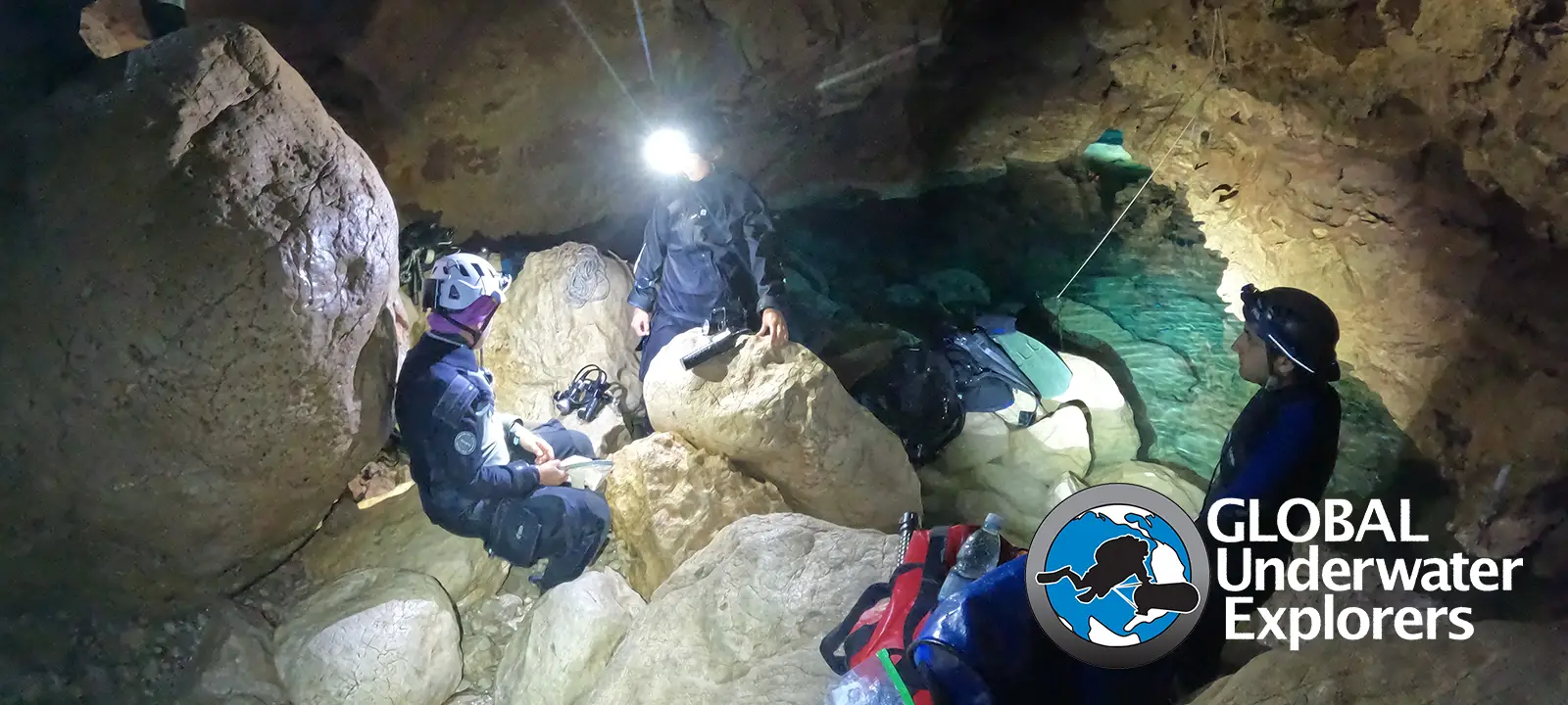
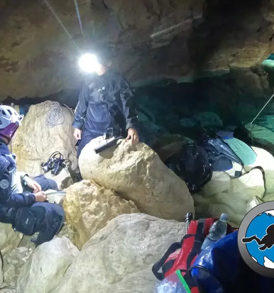
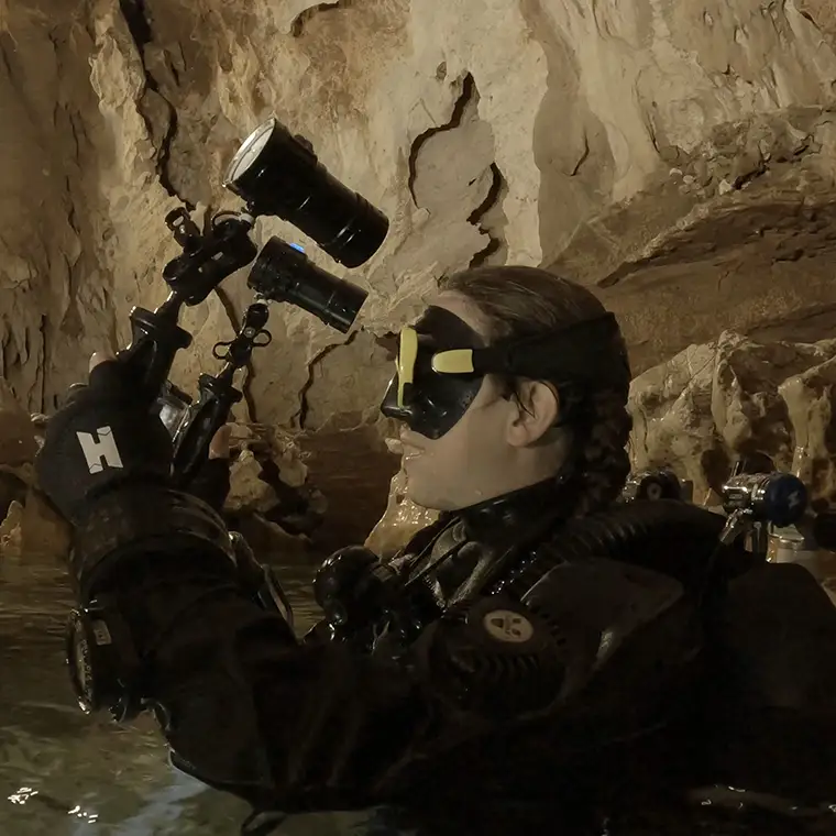
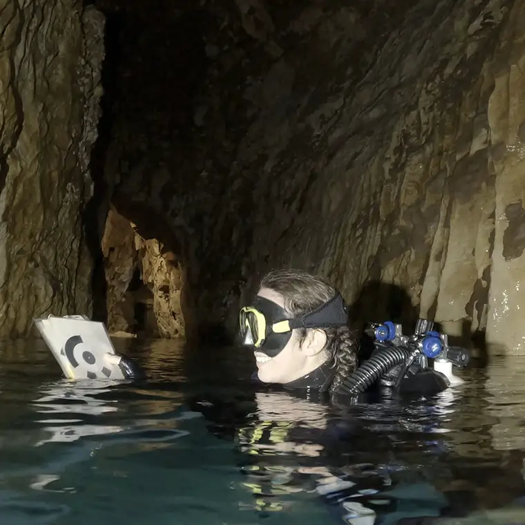
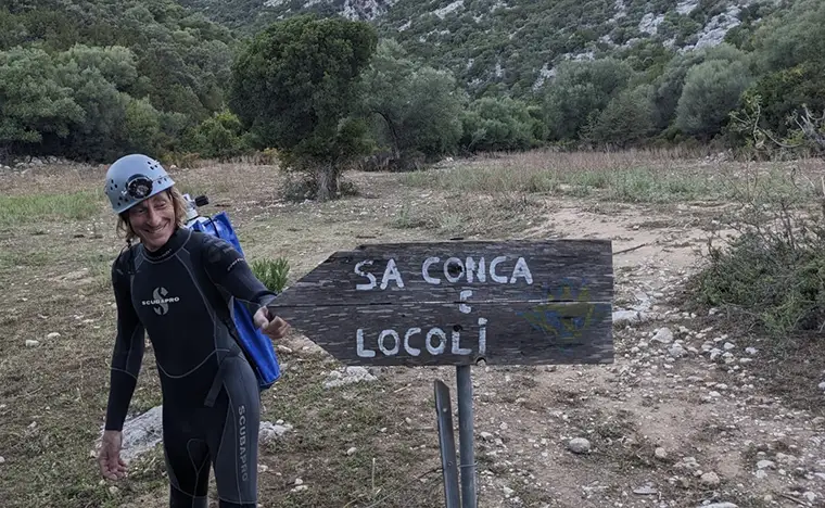
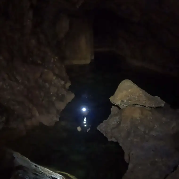
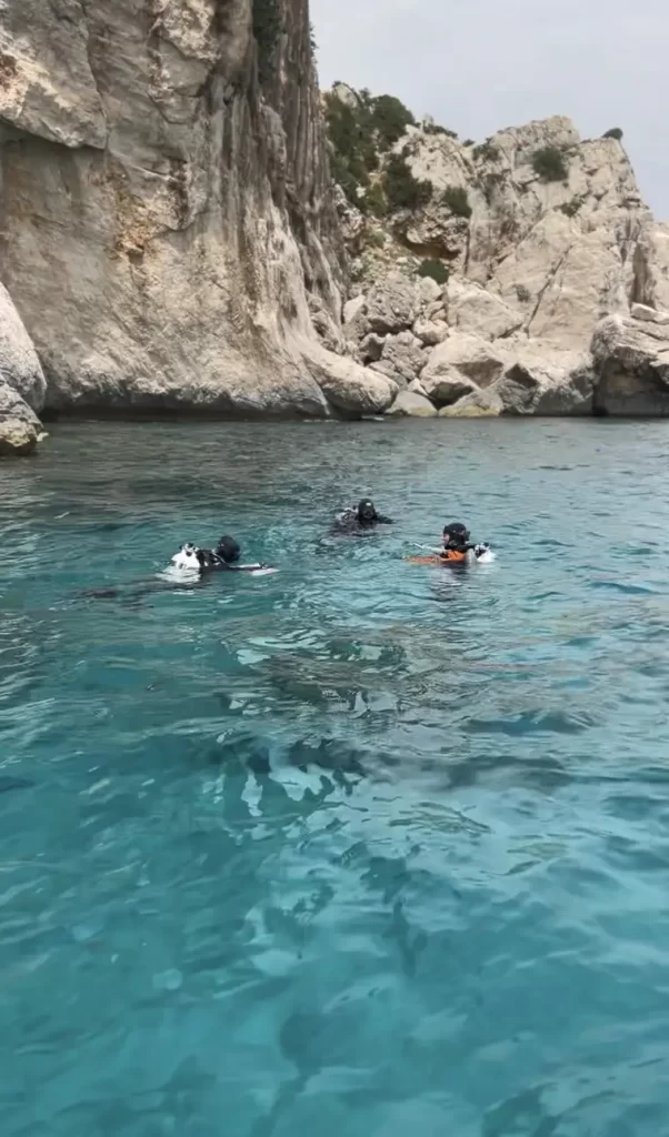
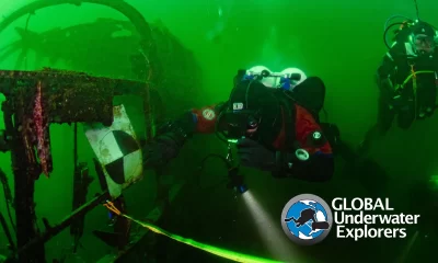
by Jenn Thomson. Images by Jenn Thomson, Greta Friewald and Todd Kincaid. Lead image: Welcome to the bio-speleology base camp—members of Phreatic reaching Sump 1 at Locoli cave, preparing for a 2.5-hour dive. Photo by Jenn Thomson
Ever dreamed of being involved in a dive project, but don’t think you are qualified enough? Think again! From being a scientific dive teammate, to report writing and social media, there are multiple ways to be a pivotal part of a dive team within your individual capacities. Here , Jenn Thomson, a newly certified GUE cave diver and volunteer for Sardinian-based non-profit organization Phreatic , takes us through three different cave projects she participated in as both a diver and topside support over the summer, showcasing all the ways you can make a difference!
“Remember where you are when you realize how good you are.“
Those words were spoken by my friend Todd Kincaid in Cala Gonone, Sardinia, where members from the dive centre Base 1 and representatives of SUEX diver propulsion vehicles (DPV), were having dinner together. It may have been a passing phrase, but we all took it to heart over the following weeks.
You see, with Andrea Marassich as my instructor, I had just become a certified GUE Cave 1 diver. This was a milestone that I never thought I would reach. Andrea likened the certification to a driving licence versus actually driving a car (which takes more experience and time), for I and my buddy were “enthusiastic, highly skilled, and highly inexperienced.” In other words, he had opened the door for us, and now it was up to us to improve our cave diving capacities.
And what better way than goal-orientated diving? For the record, I still DO NOT think I am ‘good,’ but I am motivated to become better, and I have other non-cave skills (photogrammetry, diving medical technician certifications, single rope technique courses, and scientific data analysis). This—coupled with gaps in projects that fit my level of competency and certification limitations—allowed me to participate in three projects after my cave course. [Ed. note: GUE Cave Diver 1 divers can go up to the second T (navigate 1 x T only) and use 1/3 of 2/3 gas for penetration, no stages; max depth 30m/100 ft, no complex navigation such as jumps or traverses].
My name is Jenn Thomson. I am a past expedition scientist and last year’s GUE NextGen Scholar, and I have since made every effort to live out my global-nomadic-science-diving dreams, even after my amazing scholarship year had ended. For the past six weeks,I had been living in Cala Gonone, home base for both Base 1 (GUE Premium Dive centre) and Phreatic Organisation A.s.P, immersed in all things cave.
Note that I do not focus so much on the technical details of each project here; instead, I explore general concepts, the contributions that I managed to bring to the team, and lessons learned. Hopefully this will show you that, whatever your level and skill, you can always contribute something meaningful to a project, increasing your value for the next time.
PROJECT 1: GROTTO DEL FICO PHOTOGRAMMETRY
- MY MISSION: Photogrammetry of the dry and beginning sections
- LESSONS LEARNED: Perseverance and real-life photogrammetry experience
- TAKE-AWAY: Swinging washing lines don’t work for placing markers 🙂
- CAVE: Grotta del Fico
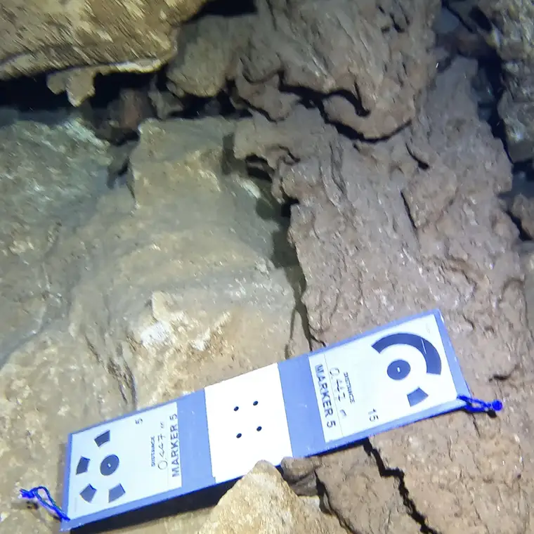
Captions: A Cave 1 diver’s photogrammetry duties: capturing images of the dry and cavern sections, laying down markers, testing photography of the air-water interface, and of course, the dive itself. Photos by Jenn Thomson and Greta Friewald.
My first experience dives after the GUE Cave 1 course were also my first project dives with Phreatic—five days in which I and a team of other divers helped to continue the photogrammetry of Grotta del Fico cave in the Gulf of Orosei. Photogrammetry is a vital tool for documenting cave systems, creating 3D models from many overlapping photos of the cave structure. This technology captures precise measurements and details without damaging the cave itself, aiding in geological and biological studies. It also helps to create immersive virtual reality videos that allow the next generation of non-divers to see the caves for themselves. Ultimately, photogrammetry models inspire a call to conservation action.
Led by PhD student and researcher Matteo Collina, this project was a continuation of last year’s efforts wherein a 3D model of Del Fico had already begun to take shape. In 2023, a model was made from inside the cave: after the restriction before the first shaft down. This year, we ultimately wanted to connect the cave model with the outside environment—which meant mapping various restrictions, small air pockets, dry sections, a section of no-visibility hydrogen sulfide, and the cavern portion at the start of the cave. Phew! This was going to be very challenging technologically for the photogrammetry software, but we had plenty of teams to play around with various techniques.

To us—the C1 divers and me—it made no sense to travel to the furthest sections of the cave to then start taking photos, especially since (as I discovered), bringing even small markers and a GoPro camera rig through the small passages was harder than I expected! So, we focused on other tasks: obtaining project B-roll and trying to map the dry and cavern portions that were just before the main line . Although I had done some photogrammetry before, small objects were certainly different from large environments, especially when I had to contend with sometimes sandy bottoms with no features. My first attempt was not well-aligned to say the least, but I had lots of chances to return and make overlapping images.
It was also fun to attempt to model the air-water interface using markers that bridged the gaps between the two mediums. My GUE instructor buddy Gemma and I did try to make a ‘washing line’ out of various spools attached to tiny weighted markers (to get them to float in/out of the water), but to no avail. Lessons learned—the work continues. We are looking forward to next year, when we’ll connect all the missing collections of images (especially at the interface of air, water, and the additional hydrogen sulfide layers). For me, this also defines project success; we now know what does not work, and we have a renewed sense of direction for next year as well.
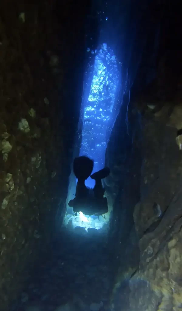
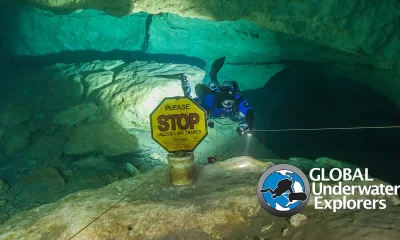
PROJECT 2: LOCOLI BIOSPELEOLOGY AND HYDROGEOLOGY
- MY MISSION: Science and dive support
- LESSONS LEARNED: Resilience and the value of topside assistance and knowing where to listen to a “No you are not going today.”
- TAKE-AWAY: I need more muscle mass
- CAVE: Sa Conca e Locoli
No sooner had we finished the first project when we were on to the second. This time, we were assisting several scientists from Brussels University (led by Fabio Stoch) in their mission to investigate the Locoli cave ecosystem. Our objectives were threefold:
- Biospeleology: setting bait and collecting specimens using nets and traps (i.e., finding ‘cave bugs’ to ascertain the life inside this system)
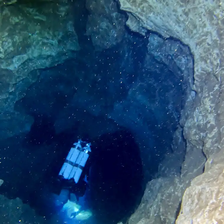
- Sensor deployment and video documentation of various phreatic passages and dams inside the cave system (acting as a reference for hydrogeology studies in the future)
- Collecting water samples for on-site filtration to secure eDNA (traces of DNA that are released by organisms into the environment that help to paint a picture of the life inside the cave)
Getting all of this gear in and out of the cave was another matter. As support, my days were spent watching topside for the divers—but also clambering up and down giant boulders, rock climbing up and down 10 m+/33 ft+ walls carrying tanks on my back, rigging and pulling DPVs up the same walls, swimming across lakes with pulley systems to transport the scientific equipment that could not get wet. It truly was one of the most physically challenging weekends of my entire life—with extra days before and after the mission to retrieve the final tanks and bits of gear that we could not manage to take out in one go. Stay tuned for the results soon!
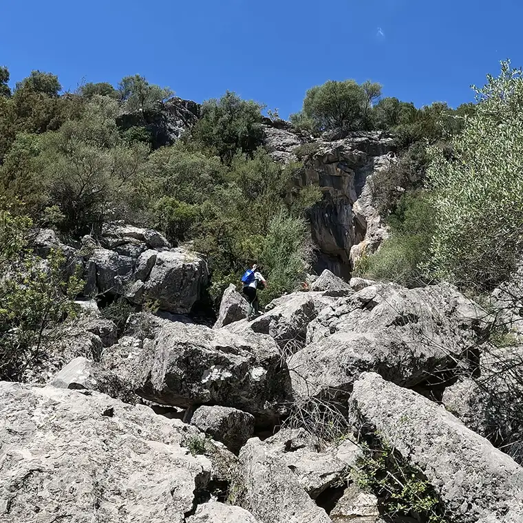
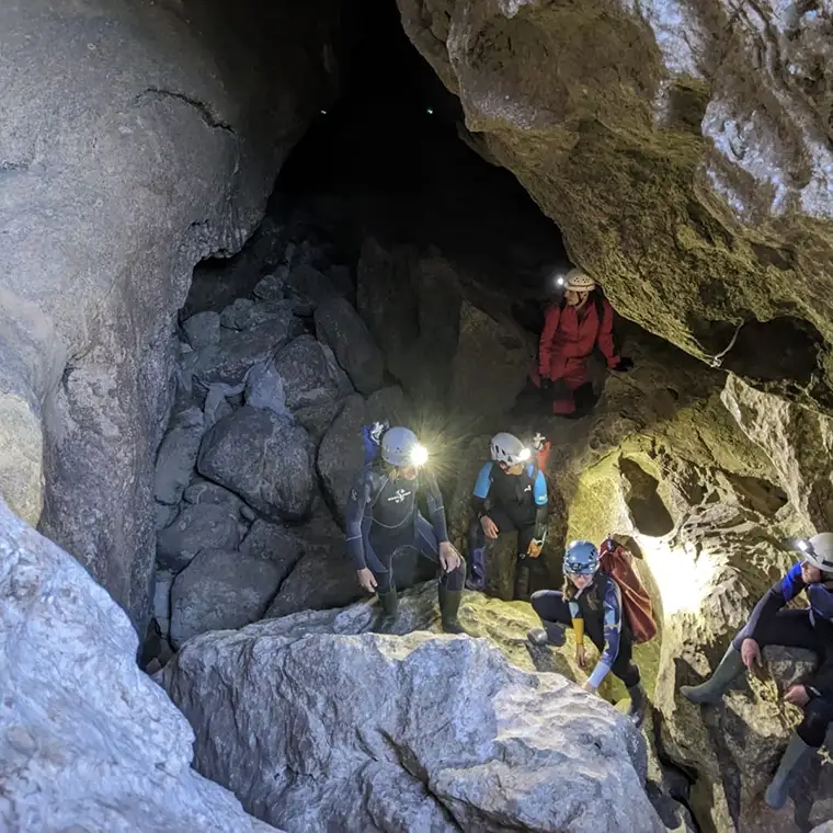
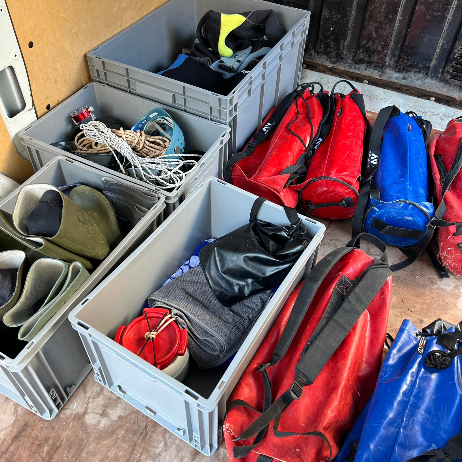
Captions: A topside support’s mission: carrying tanks, rock climbing, swimming across lakes and of course, making sure that everything has been packed! Photos by Jenn Thomson and Todd Kincaid.
Note that the Locoli expedition is not for everyone. To get to the beginning of Sump 1 requires the use of ropes, swimming, and rock-climbing to haul gear as aforementioned. The dive team was comprised of a few select divers using sidemount, stages, and DPVs. They had to be able to clamber in and out of sumps and dams in the upstream and downstream sections while wielding all the additional scientific and documentation gear. Even without diving, I gained so much experience with my role, and it was a privilege to help this team in some small capacity (even though I had to be given the ‘lighter’ bags to carry, and that I indeed sink when carrying a steel tank across the freshwater lakes!).
One rewarding memory was when I was carrying a tank into Locoli for the first time. I remember finally reaching the first ‘hard’ section: a steep, vertical climb with one slim rope. I stopped, thinking, “I have to do this while carrying 10-15kg?!” I was with Todd Kincaid, Andrea, and Dorota at the time—the latter two were watching out for me up top, and maybe suggested that I take off the weight. After steeling myself, I said “Let me rephrase that. I will not TRY to do it, I WILL do it,” and then proceeded to climb up, much to the whoops and delight of all three. This truly gave me the confidence to continue and by the end of the mission, and I was carrying bags for other individuals up the ropes and making multiple trips in and out of the cave. Note to self: you can do hard things!
PROJECT 3: CALA LUNA CARTOGRAPHY
- MY MISSION: Cross-sectional drawings of points of interest
- LESSONS LEARNED: Re-defining tasks and re-finding my inner artist
- TAKE-AWAY: Be comfortable with just ‘starting’ to draw, and being in vertical trim
- CAVE: Cala Luna
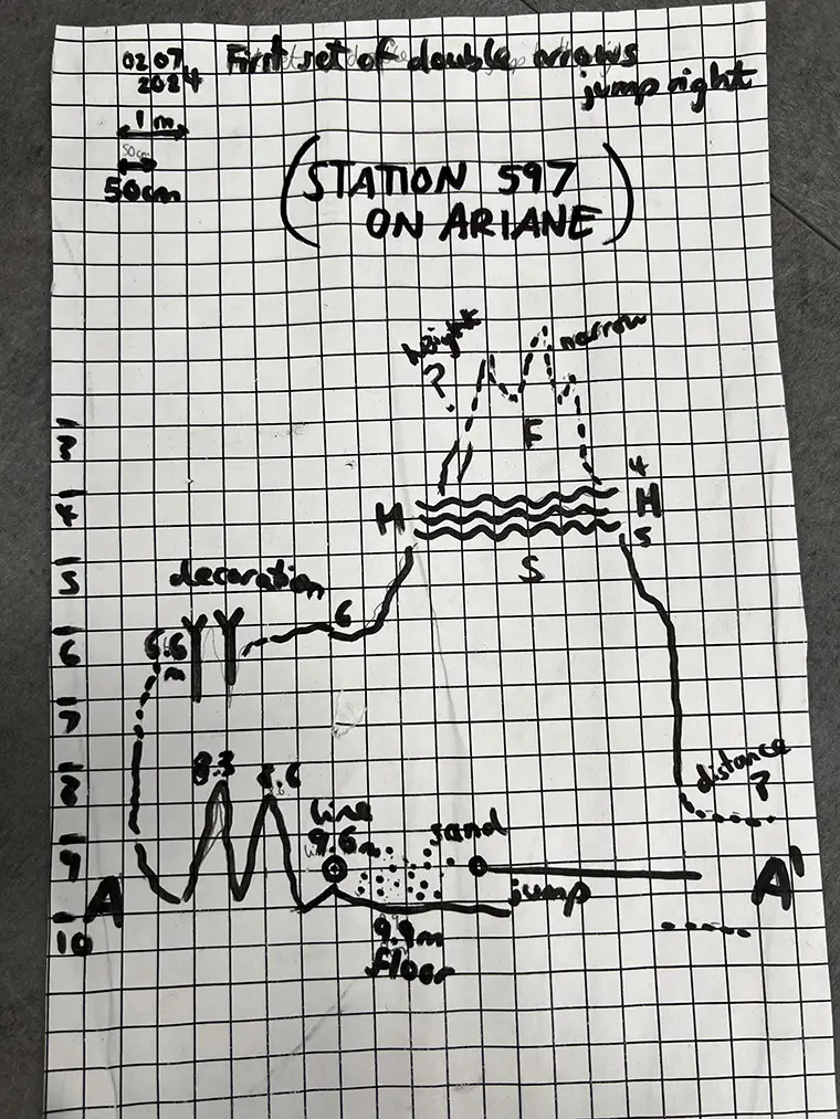
Captions: A Cave 1 diver’s supplementary tasks to surveys: cartography, cross-sectional drawings, and taking footage for social media. Photos by Jenn Thomson.
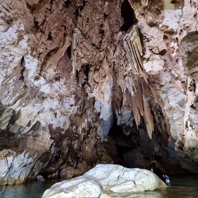
Cala Luna is a very pretty cave in the Gulf, the entrance of which is defined by a long, narrow passage up to the main line. This project week had several goals to complete, depending on team numbers and order of priorities: 1) Re-lining the main line up to T1, 2) Drawing after the first T (plan and profile view), and 3) Re-surveying the cave after the second T. My role as a C1 was initially task 1, but after an initial scouting dive— where we ascertained that the hydrogen sulfide layer was just too dense and wide for us to work on our first re-laying efficiently—the C1 team switched over to the drawing team.
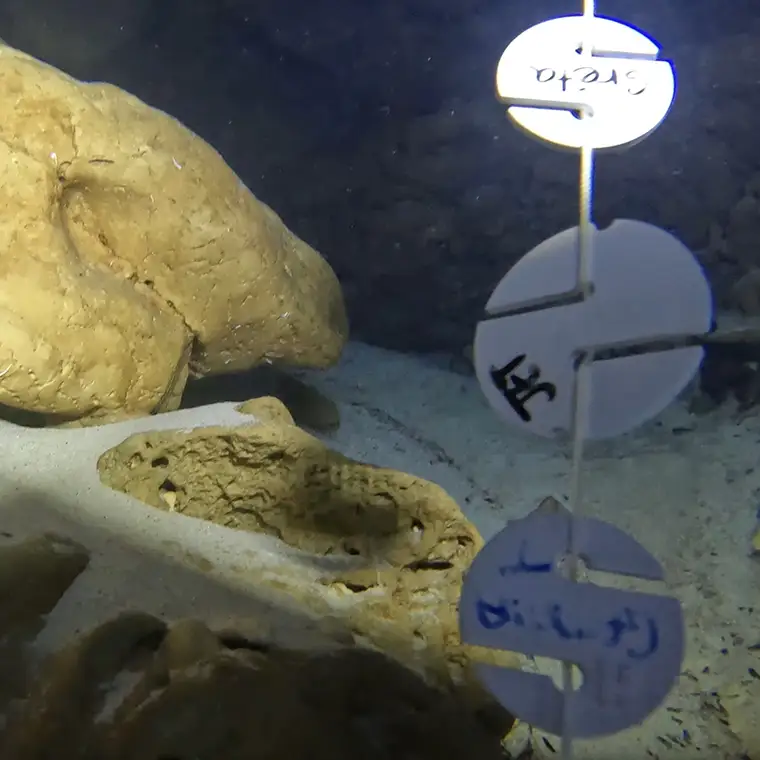
Cave documentation begins with creating an initial survey. Using the main line as a reference, divers can record the depth, distance, and azimuth between each tie-off point or changes in the cave. This can also be done with specialist tools such as the MNemo. The data collected is then plotted on paper or digitally gathered to produce a scale drawing that represents the cave’s layout and structure. Surveyors often work in teams, with one person handling the instruments and another recording the data. Key points—such as significant formations, junctions, and changes in passage direction—are noted and sketched. This process helps in creating detailed cave drawings: the mission for the divers that were able to work for longer between the first and second T (task 2). They were charged with creating plan views (the top-down perspectives of the right and left walls and features) and profile views (the side perspectives of the top and bottom) of the cave.
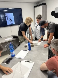
My buddy George and I were drawing the cross-sectional areas of a few key sections from the main line to T1—points of interest. It was certainly a lot to think about when you arrive at the site (armed with gridded paper and multiple pencils) and realise that you must make a detailed to-scale drawing of it! However, even with limited gas time available, we worked well as a team. One person sketched out points of interest, larger features, and then smaller details; while the other provided light, took vides, and noted the depths of the main line or haloclines for example, to cross-reference with our often-overestimated distances on the sketches.
I loved this project: The goals for C1 divers were achievable, we produced three to four cross sections, and had too much fun in vertical trim drawing all the speleothems that this beautiful cave has to offer.
A NOTE ON PHREATIC ORGANISATION
Phreatic.org is a non-profit organisation committed to the exploration, documentation, and conservation of underwater environments in northeast Sardinia. Their mission is to combine scientific research, technological innovation, and community engagement to improve the understanding of marine caves and groundwater systems. Ultimately, they aim to protect these fragile environments for future generations, and they cannot continue their important work without the generous support of dedicated volunteers.
For the project season in June, they would like to thank all the contributing divers and project leads: Matteo Collina, Olga Martinelli, Jennifer Thomson, Andrea Marassich, Gemma Thomas, Dorota Czerny, Greta von Friewald, Jordan Allured, George Polykratis, Sven Nelles, Claudio Parco, Harald Hase, and Marcello Iacca; collaborating scientists Oliver Collard, Fabio Stoch, and Gianfranco; and all those who also carried tanks in and out of Locoli, including Todd Kincaid and Jarrod Jablonski. If you also want to make a difference, support their cause here.
DIVE DEEPER
InDEPTH: EXPLORING AND DOCUMENTING SA CONCA ‘E LOCOLI CAVE by Andrea Marassich
InDEPTH: Charting Sardinia’s Grotta del Fico By Gatien Cosendey.
InDEPTH: How I Became a Scientific Diver by Jenn Thomson
YouTube: Mapping The Darkness—Sneak Peek

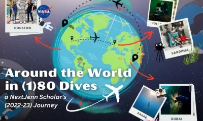
Jenn Thomson was GUE’S NextGeneration Global Scholar for 2022-2023 and used the year to highlight the roles that recreational scuba can play in scientific operations. From behind-the-scenes astronaut training at NASA to ecosystem surveys in the Middle East, she aimed to inspire young upcoming divers! She completed drysuit/doubles primers, Scientific Diver, Rec 2, and an ITC among other courses. Ultimately, she aspires to work at the intersection of project diving, expedition vessels, and Neutral Buoyancy Labs—connecting the space and marine sectors via scuba and exploration. Jenn joined GUE HQ part-time in January 2024 to help with all things global project coordination, Project Baseline, and the NextGen Legacy Project. She is currently trying to get an Italian visa to continue exploring the Sardinian caves with BS1/Phreatic. Email: [email protected], Instagram: @jennelizabeththomson


Los Factores de Gradiente en un Mundo Posterior a las Paradas Profundas

Can You Really Make Diving a Day Job? The Realities of Full-Time Tech Instruction
Deco Dilemmas: The Push for Personalized Decompression Modeling

An Analysis of Cave Diving Accidents

What Not To Die For: A Guide to Efficient Expenditure of Human Resources

The State of Personalized Decompression