Latest Features
A Primer on Underwater Navigation Technology
Underwater navigation seems like an obvious and useful extension of our dive computing capabilities. So why aren’t U/W NAV systems more prevalent? Former Shearwater director of sales and marketing Gabriel Pineda reviews the technology that exists today, discusses barriers to adoption, and offers some alternative approaches, including DIY solutions, to the problem of finding your way underwater.
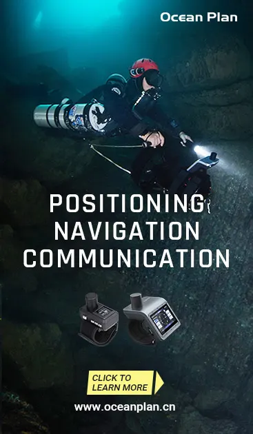
By Gabriel Pineda. Lead image: Ocean Plan’s Navigator Pro. Other images courtesy of G. Pineda unless noted.
Bones
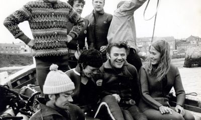
My friend Curt McNamee always tells me that connecting with divers is all about sharing your stories. It binds you together as a community, and you can relate at a personal level. So, Curt, here’s one of my stories.
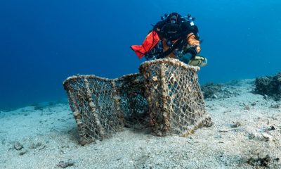
More than a decade ago, Eric Cayla and I were shore diving in a little cove local to the Metro Vancouver area. We did the wall in the edges of the cove and, as we were going deeper, at around 27 m/90 ft, we found the bottom that was mostly sand and mud. Nothing to write home about, right?
However, the dive became a little more exciting when we came upon a rib cage. Based on the size, it looked like it could belong to a large person. There were some vertebrae strewn around and some still attached to the ribs, but I could not see any other recognizable bone. We were fascinated with the discovery. Many thoughts were running through my mind. What are we going to do about this? Are these human remains? Have we stumbled upon a crime scene?
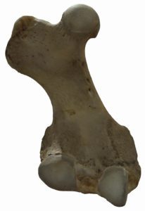
We kept on looking around trying to decide what to do, and eventually I stumbled upon a ball joint. The bone was complete and unbroken. Because it was complete, I could see it was either a femur or a humerus (pay attention to science class, kids). Its short size eliminated any possibility of this being a human bone. It had to be the bone of a seal or juvenile sea lion.
Then I felt at ease. Which brought my mind back to our diving. I checked my spg and asked Eric for his tank pressure. In our fascination and excitement we had spent way too much time at depth, inadvertently breathing more than usual, and we had gone into the reserve gas territory of our single tanks. Thankfully, we hadn’t broken the NDL. Nevertheless, we had to ascend directly to the surface from the bottom because we didn’t have enough gas to go back to the wall and try to reach shore. I signaled the immediate ascent to Eric and he agreed.
This was a shore dive, and neither of us was carrying an SMB. The upper levels of the water column were thick with a plankton bloom that killed any semblance of visibility. We stayed close to each other and started our ascent using our computers to regulate the speed. As we ascended, I developed growing concerns around our location. Were we still in the cove? If we were outside, we could be in a tidal current, and there was a nearby ferry lane. Was the current going to sweep us far away from our entry point? Were we going to end up on an island? I wished I had an underwater GPS with me!
Why didn’t we have underwater GPS?
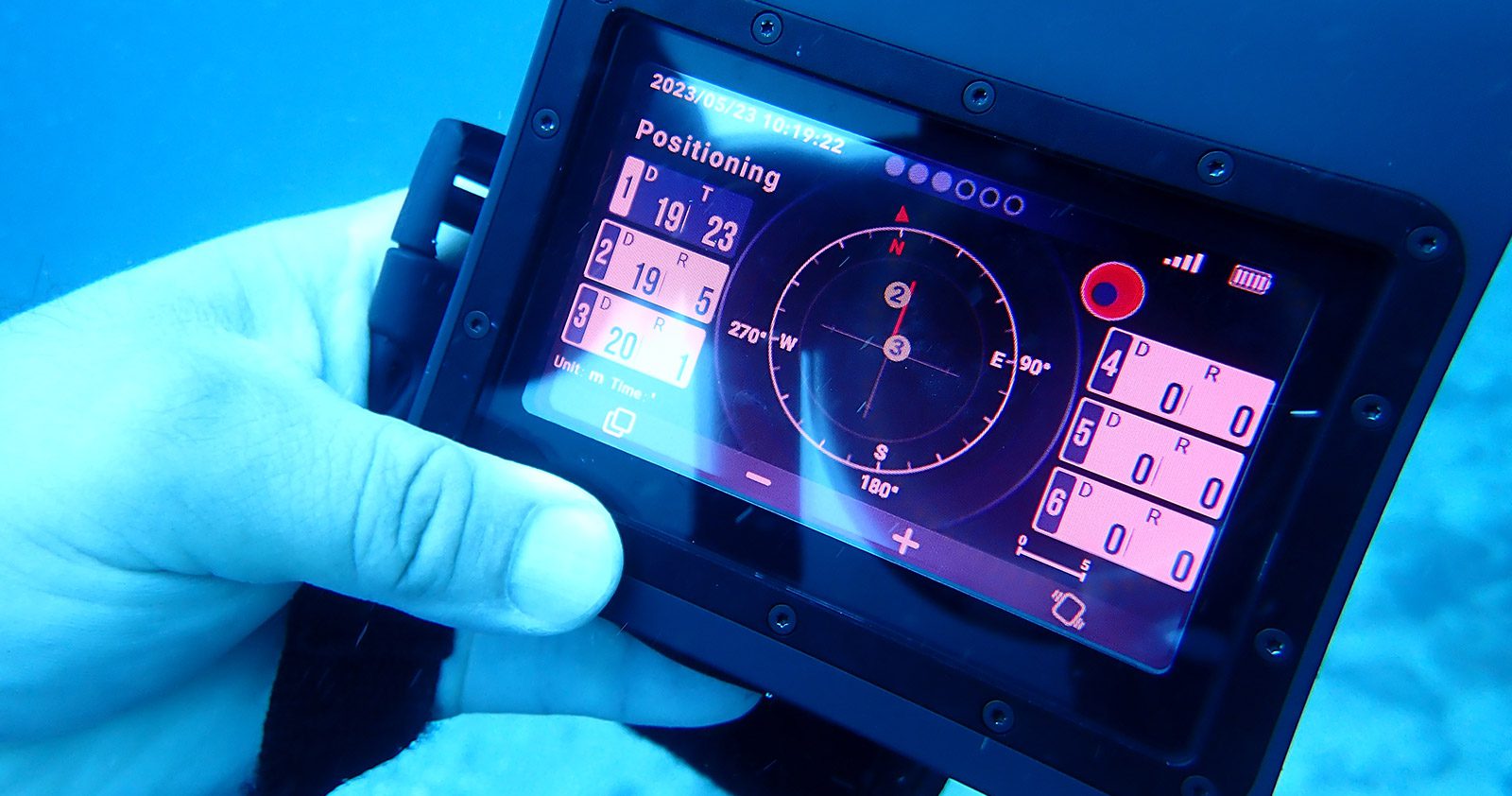
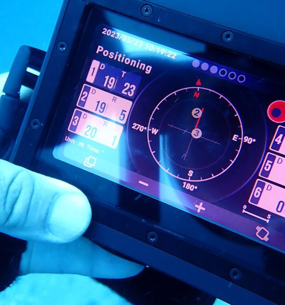
The short answer is that GPS signals do not travel underwater. We can bypass this limitation by pairing GPS with an USBL. Not to be confused with the ubiquitous USB (Universal Serial Bus) in laptops and cell phones, USBL stands for Ultra-Short Baseline.
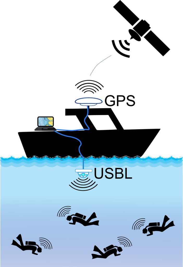
USBL is used for precise underwater positioning. It works by sending acoustic signals from a surface transceiver to an underwater transponder which then sends a response signal back. By measuring the time it takes for the signals to travel, USBL calculates the distance, enabling accurate tracking of underwater objects. It’s used in subsea exploration, offshore industries, scientific research, and it provides centimeter-level accuracy. It typically has a range of a few kilometers or less.
While USBL can provide very accurate underwater positioning, its accuracy can be affected by factors such as thermoclines, haloclines, and the presence of obstacles or acoustic interference.
Many USBL systems can also integrate inertial sensors like accelerometers and gyroscopes to improve accuracy. These sensors provide information about the object’s orientation and motion.
GPS (Global Positioning System) data from the surface can be integrated with USBL measurements for even more accurate positioning.
So why don’t we see more divers using underwater GPS with USBL?
GPS/USBL systems for divers are available. Check out some of these:
- https://diver6.azimuthinc.com/
- https://www.sonardyne.com/products/divetrack/
- https://en.oceanplan.cn/
- https://waterlinked.com/underwater-gps
- https://uwis.fi/en/
- https://www.navimate.com/
- https://www.divenetgps.com/gps
- Serenity Concept S2 sonar –
The last link refers to a product whose website is no longer active. We are not sure if the company is still a going concern.
Barriers to entry – Pricing
Prices on most or all of these systems range from tens of thousands of dollars to hundreds of thousands depending on system capabilities and other factors. It is difficult for a sports diver to commit that kind of funding to adopt a navigation system. For the most part, sport divers can argue that their $60 mechanical compass is sufficient for their underwater needs. The leap from the existing traditional navigation tools to a GPS/USBL combo is simply too far.


Barriers to entry – Practical Ergonomics and Logistics
A GPS/USBL combo will need a topside platform supporting transceivers, mapping, and data communications hardware. Sport divers do not usually enjoy the benefits of a surface support crew much beyond getting spotted and picked up by the dive boat.
If it is a shore dive, the team of divers will need to carry, deploy, anchor, and secure a buoy or an otherwise adequate topside support platform. Diving in physical overheads will almost certainly pose physical barriers that impede functional ultrasonic transmissions.
If we take my story at the beginning of this article, my buddy Eric and I would have had to carry out the topside equipment down a steep forest path along with our regular gear. We were not planning on diving outside the cove. In addition to our mechanical compasses, we would use bottom terrain features to figure out our location at any time, as we had done many times before. There would’ve been no need to carry heavy additional navigational equipment and swim to the center of the cove to anchor the topside hardware. The whole logistics around setting up GPS/USBL would have likely taken more time than the actual bottom time of our planned dive.
Also, we weren’t planning on doing a blue water ascent in low visibility. So much so, that we didn’t even bother taking SMBs. Later that day, during our debriefing, I recall Eric telling me he’s never diving again without an SMB. All of which brings up the point that in this particular case usage, a typical diver feels ok using a $60 compass with a $60 DSMB to address the eventuality of having to do a blue water ascent.
The bottom line is that typical missions that sport divers undertake on a regular basis wouldn’t be improved upon by carrying and deploying a $20,000 GPS/USBL for two divers. If you look at it from the point of view of a dive boat operator, it would be difficult to convince them to invest $70,000 in GPS/USBL for four to six people. Would the boat divers be willing to pay twice as much for using the GPS capabilities? I doubt it. They are more likely to procure a $300 Nautilus Lifeline to carry passively in their pockets until they encounter a situation that warrants activating it.
A high end exploration liveaboard in a remote dive site might present a more viable case usage within the sport diving segments. But now the case usage gets limited to a narrow band of niche users, with the consequent reduction in market massification opportunities, thus keeping acquisition costs high.

Dead Reckoning – more than a cool zombie cowboy name
An alternative path to adoption of electronic underwater navigation is to stop trying to have a permanent live connection to GPS using Dead Reckoning (DR). DR is a method of navigation used in various fields, including maritime, aviation, and terrestrial navigation. It’s a technique for estimating the current position of an object based on a previously known position, the object’s course, and its speed. DR is particularly useful when other means of determining position, such as GPS or landmarks, are unavailable or unreliable.
Here’s how Dead Reckoning works:
- Initial Position (Known Fix): To start dead reckoning, you need an initial known position. This could be obtained from a GPS reading, a visual landmark, or any other reliable method of determining position.
- Course, Speed and Time: Dead reckoning requires knowledge of the object’s course or heading. This is the direction in which the object is moving. You also need to know the object’s speed. Dead reckoning relies on the concept of time. You need to know how much time has passed since the last known position fix and before any changes in course or speed.
- Calculating New Position: Using the initial position, course, speed, and time, you can calculate the estimated position of the object at a future time.
- Updating the Position: As the object moves, you continuously update its position based on the course, speed, and time. This creates a series of estimated positions, each based on the previous one.
- Error Accumulation: It’s important to note that dead reckoning is subject to errors. Small inaccuracies in course, speed, or time measurements can accumulate over time, leading to a less accurate estimated position.
- Using Additional Data: To improve the accuracy of dead reckoning, navigators often combine DR with other navigation methods and data sources. For example, they may periodically take new position fixes using GPS, landmarks, or celestial observations and use these fixes to correct the dead reckoning estimate.
DR is a valuable navigation technique, especially in situations where continuous access to GPS or other external references is limited. However, because it relies on estimates and can accumulate errors, it’s typically used in conjunction with other navigation methods to ensure accuracy and safety, especially on long journeys or in complex environments.
Project Ariadna from Finland seems to be taking the DR approach. They claim to be working on “fully independent underwater navigation technology with no external transmitters, no ultrasonic signals and no infrastructure.” I saw them in a DEMA show a few years back.

They take their initial known fix at the surface via GPS. Once underwater they measure course, speed, and time using an array of 11 independent sensors sampling their respective data 400 times per second. I assume the 11 sensors are an array of accelerometers, gyros, compass, (essential components) etc. The elevated sampling rate of 400x should provide a rich depth of data that allows reduction of error accumulation.
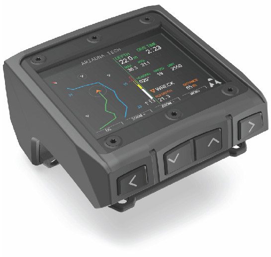
Their approach seems promising. If they are able to bring up an ergonomic and reliable product under a reasonable cost, this could end up being a viable pathway for widespread adoption in sports diving segments. On their website they state that their “goal is to put a personal navigation system on every scuba diver’s wrist.” While I doubt that 100% market penetration is realistic, they may be able to gain enough market share to pass the critical points into financially sustainable economies of scale.
Rooted in DIY – Other paths to scalability
Let’s look at how other tech was adopted by sport divers and see if we can apply those lessons to electronic underwater navigation. Backplates and wings are very common with sport divers. But the legend says that the first backplates were actually aluminum road signs bent into the right shapes and drilled in the right places. Ryan Taylor published a recreation of the road sign approach in 2018: Making a DIR Backplate.
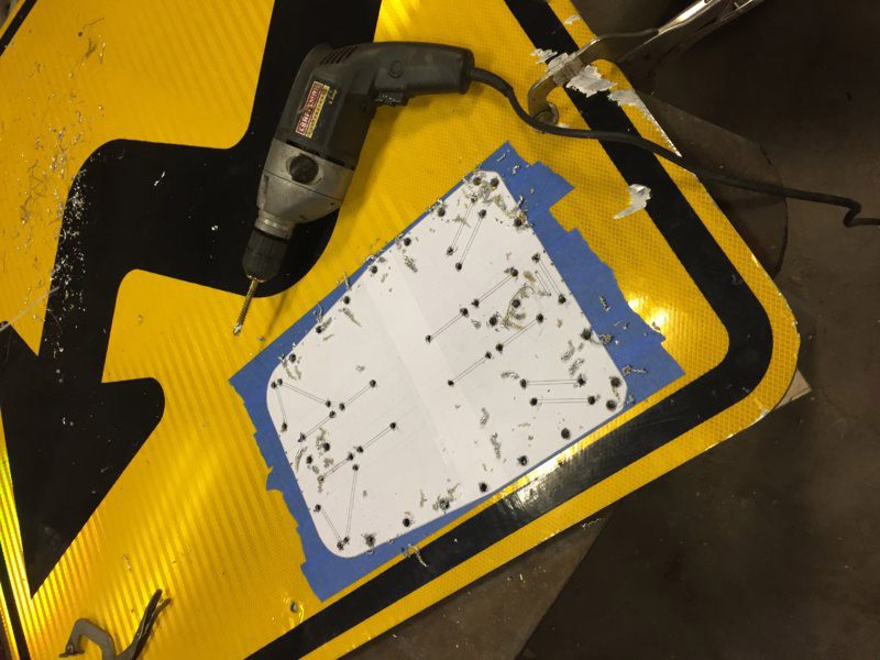
Today there are many quality brands commercially producing superb backplates. It went from DIY to widely available commercially at reasonable prices.
Another example is sidemount buoyancy bladders. We all saw Rick Stanton sporting his innertube sidemount rig in the Nat Geo documentary “The Rescue”.
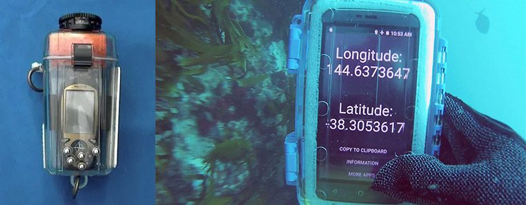
There is a DIY version of the electronic underwater navigation that could potentially be refined and present a staged road map for widespread commercialization. The concept is fairly simple. Grab an old smartphone or GPS receiver and put it in an appropriately depth rated case that allows for reception of GPS signals at the surface. Tie the case and phone to a spool and take it underwater with you. Whenever you want to check your location, float the phone and case to the surface and then bring it back down to you along with an update of your coordinates.
See here: Cool Solutions for Using GPS Underwater and here: Scuba diving with an underwater GPS (sorta) mobile phone in waterproof case & GoPro GPS
This path to adoption could piggyback on existing platforms to facilitate deployment and reduce costs.
Version 1. A small, slightly positively buoyant GPS receiver could be attached to a small spool with a thin cave line. After getting updated coordinates and being retrieved back to the diver at depth the GPS receiver can transmit coordinates to the dive computer wirelessly using the same frequency that wireless pressure transmitters use. The dive computer in the wrist of the diver has a preloaded map of the dive of that day. The dive computer can then pull up the preloaded map and put a pin in the latest coordinates received from the last retrieval.
Version 2. The thin line in the spool is now a thin data cable and the underwater data transmitter is now in the spool relaying the coordinates to the dive computer while the receiver is still top side. As long as the receiver is topside the computer is receiving coordinates in real time.
Version 3. New dive computer version with more accelerometers, gyros, sensors that allow for less dependence on GPS receiver. This new dive computer is now closer to what the Ariadna Project is aiming to create if they are successful scaling their idea down to a wrist device. However it is also a full blown trimix OC/CCR dive computer – it was a dive computer to begin with.
Version 4. Could include a miniaturized USBL allowing for going back to just a plain thin cave line as the tether while maintaining a wireless data connection to the topside GPS information.
Version 5. Could be a miniaturized wireless GPS/USBL with servos that allow it to follow the diver from the topside untethered feeding location data on a real time.
Version 6. Could include data comms with dive boats or emergency services.
And so on. The point being that it is an iterative, purposeful process where earlier versions fund the development of latter versions, and the whole process is economically self-sustained. This type of approach requires a long term vision and commitment to the vision.
In conclusion, what happened with the Bones Dive ascent?
As Eric and I ascended, Eric seemed to notice that I was stressing out. He stopped and got in front of my face and gave me the OK signal. This was enough to refocus me. Stop, Breathe, Think. I returned the OK signal and resumed the ascent with a much more focused attitude.
You have to appreciate your good dive buddies. Those that can tell that something is starting to be off and know how to communicate effectively defuse the situation before it spirals out of control.
As we got closer to the surface I started hearing laughter and voices. I was very confused because I heard no boat and we should not have been anywhere close to shore. At least not close enough to hear the voices with such clarity. I surfaced and Eric was in front of me, but there was nothing behind him. I turned around and there was a couple and their teen daughter in a small aluminum boat. The boat was very close to me.
It turned out that the people in the boat found our bubbles and thought we were whales or some other marine mammals. They turned off their engine and followed our bubbles until we ascended. This is why Eric vowed to always carry a DSMB from then on. He was not going to be confused with a pinniped or cetacean ever again.
So, having an underwater GPS at that time would have allayed my fears about surfacing in a ferry lane or on the shores of some uninhabited rock, but it would have done nothing in terms of telling me about the boat that was shadowing us. Goes to show you that sometimes the most simple tools tend to be the most useful ones.
DIVE DEEPER
Diver6: System Overview – Diver Tracking and Monitoring
Diver6: Fast System Facts
Sonardyne: DiveTrack beta testing with Shearwater

Diving has been in Gabriel’s family for four generations. Gabriel started diving in 1990 with his father. His father started diving circa 1964 with his grandfather. These days Gabriel’s 14 year old son is his most frequent dive buddy. As a certified advanced trimix diver, Gabriel enjoys diving rEvo and ChO2ptima rebreathers. Gabriel started working for Shearwater Research in August 2017. In September 2018 and again in September 2019 Shearwater made the ranks of Canada’s Growth 500 list – Canada’s fastest growing companies. By the end of 2018 Gabriel was responsible for all customer facing activities in Shearwater, Sales, Marketing, Customer Service, Service Centres, and Business Development leading a team of highly skilled, consummate professionals. Gabriel stopped working for Shearwater in November 2022. During his tenure Shearwater became the computer of choice for many divers, officially including the Canadian and US Navies among others. Gabriel Pineda has a BSc in Chemistry, a BBA in International Business and an MBA from Harding University.


Dial In Your DCS Risk with the Thalmann Algorithm

Deep Tunnel Workers Go Trimix

La Grande Dérive

California Dreamin’

British Invasion—Thailand Karst Edition 2024

Harnessing the Power of ‘Educated’ AI to Improve Diving Safety